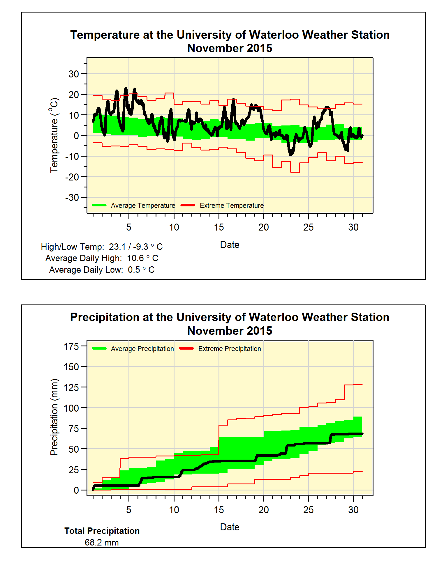
A very warm November with average precipitation
We saw some really warm days this month, in fact the high of
23.1°C on the 4th was the second hottest November day in the 100
years of records in the region (highest ever was 25°C on November 1, 1950). By the way, the high of 22.7°C the next day
was the third hottest.
There were 6 days that were 10 or more degrees above the
average and those two days mentioned above were almost 15 degrees above. Overall it was a little more than 3 degrees
above average, although this is a lot, we only have to go back to 2011 to find
a warmer November.
The month had 68.2 mm of precipitation, below than the
average of 87.1 mm, but still within the average range. Also, with only one more month to go, we have
had 748.0 mm of precipitation this year.
This is much less than the average of 832.9 mm and it means we will need
a really wet December (ie. over 100 mm) in order to avoid having a below
average year.
After not getting any snow in October, there was 12.5 cm of
snow that fell in November which is pretty much the average.
Summary for November 2015:
Maximum Temperature 23.1°C
Minimum Temperature -9.3°C
Average Daily High Temperature 10.6°C (Long term average 6.3°C)
Average Daily Low Temperature 0.6°C (Long term average -1.4°C)
Total Precipitation 68.2 mm (Long term average 87.1 mm)
(Long term averages based on 1981-2010 data for the Waterloo Wellington Airport)