A cooler May (but still barely average) with lots of rain
Last year after a cold April, May came back extremely warm,
this year not so much. The first half of
the month was about a full degree below average, but the second half was warm
enough to put us at 0.7 degrees less than average overall for the month. This was just warm enough to keep it within
the average range.
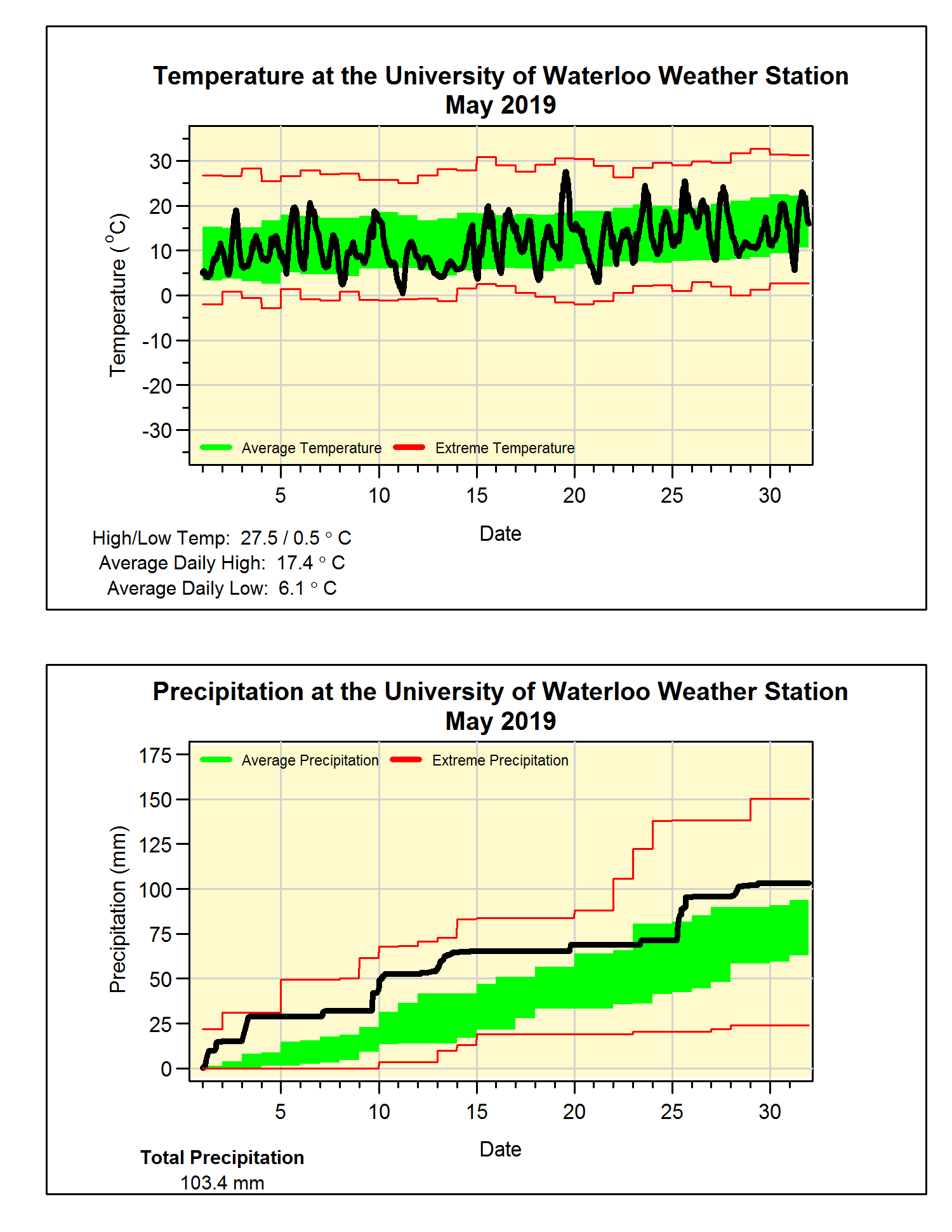
Also, unlike last year when we had 3 days above 30°C, the
highest temperature for May this year was only 27.5°C. You have to go back 10 years to find a lower
highest temperature of the month.
On the other end of the termometer, we didn’t have a
temperature below zero during May, so that means the last one occurred on April
29. This is on the early end of the
range of Apr 26 to May 23 for the last below zero temperature we have seen in
20+ years of data at the UW Weather Station.
It was a wet month with a pretty good soaking every week or
so that put the total of 103.4 mm well above the average of 82.3 mm. With 4 wetter than average months in a row,
it is not surprising that the total for the year is now 413.2 mm is now much
higher than the 340.2 mm that we would expect for this time of the year.
Summary for May 2019:
Maximum Temperature 27.5°C
Minimum Temperature 0.5°C
Average Daily High Temperature 17.4°C (Long term average 18.5°C)
Average Daily Low Temperature 6.1°C (Long term average 6.4°C)
Total Precipitation 103.4 mm (Long term average 82.3 mm)
(Long term averages based on 1981-2010 data for the Waterloo-Wellington Airport)