September was hot and the second wettest ever in the region
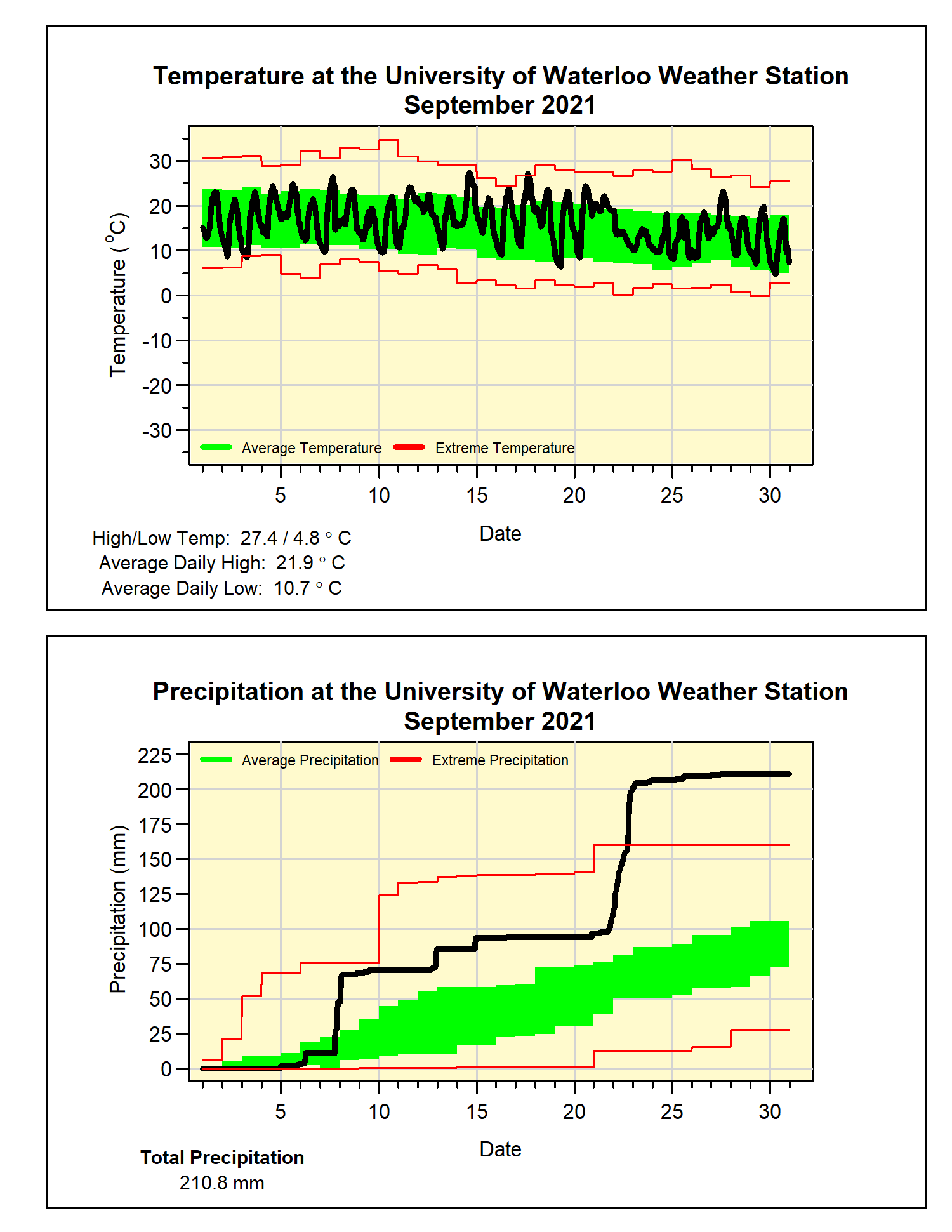
The temperature was close to average for most of September, but a warm week in the middle of the month resulted in an overall temperature that was 1.8 degrees higher than average. We still have not had a September in the 23 year history of UW Weather station that was in the below average range.
But of course the big story of the month was the precipitation and the amazing amount of rain that came down on the 21st and 22nd. Starting from 9 pm Sept 21, 2021, we saw 93.4 mm in 24 hours, this is the now the highest 24 hour total ever recorded at the station (The previous was 91.4 mm starting Jan 11, 2020 at 3 am). The total for the entire storm was 107.0 mm.
Incredibly, even without the rain from the 21st and 22nd, there still will would have been an above amount of precipitation for the month. The total for September of 210.8 mm makes it the second wettest September in the over 100 years of weather records in the region (just behind the 216.6 mm in 1986). It was also the 6th wettest for any month and the wettest month since the 223.2 mm recorded in July of 1988.
This very wet month put the total for the year of 788.3 mm well above the average of 683.5 mm.
Summary for September 2021:
Maximum Temperature 27.4°C
Minimum Temperature 4.8°C
Average Daily High Temperature 21.9°C (Long term average 20.4°C)
Average Daily Low Temperature 10.7°C (Long term average 8.6°C)
Total Precipitation 210.8 mm (Long term average 87.8 mm)
(Long term averages based on 1981-2010 data for the Waterloo-Wellington Airport)