A very dry May with average temperatures
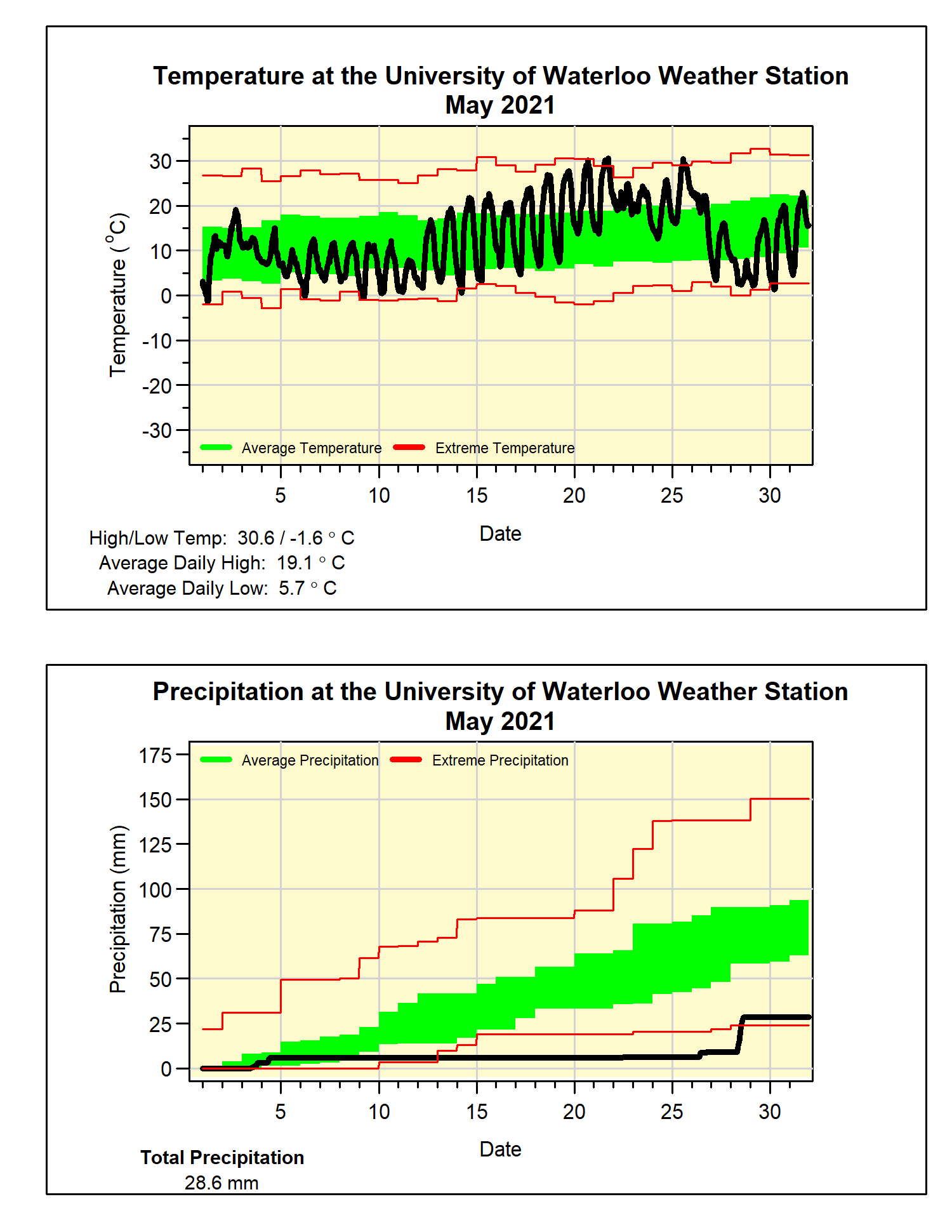
As often happens with months that have periods of cold temperatures (the start of May) and hot temperatures (the middle of May), the overall temperature turns out to be close to average. In this case very close, with the month coming in at just 0.1 degrees below average.
Assuming we have seen the last below zero temperature until the fall, the last freezing day was May 9th, this is just a couple of days later than the average in the last 20 years. On the other end of the scale, there were 3 days of temperatures over 30°C during the month, when we typically we only average one of those days every other year.
With a period of over 2 weeks of no measureable precipitation, it was looking like it might be the driest May in the over 100 year of weather records in the region. However, the wettest single day (19.6 mm) since mid-April on the 28th brought the total up to 28.6 mm for the month. It was still the driest May since 2005, but only the 9th driest in local weather data records.
This dry month puts the total for the year so far at 223.9 mm, well below the average of 340.2 mm.
Summary for May 2021:
Maximum Temperature 30.6°C
Minimum Temperature -1.6°C
Average Daily High Temperature 19.1°C (Long term average 18.5°C)
Average Daily Low Temperature 5.7°C (Long term average 6.4°C)
Total Precipitation 28.6 mm (Long term average 82.3 mm)