In the annual UW Weather Station I had a hard time figuring out where the temperature ranked in the history of the region. The reason is that the records at the Waterloo-Wellington airport only go back to 1971 so to go back further we need to use a station in Kitchener that collected data from 1914 to 1977. Unfortunately between the stations there are going to be differences in equipment, personnel, and of course the location itself making comparison difficult.
When I did a straight ranking of annual temperatures from both stations the results looked like this:
1998 - 9.98
1949 - 8.64
1953 - 8.63
1931 - 8.63
1921 - 8.63
2006 - 8.44
1952 - 8.20
2001 - 8.14
1941 - 8.12
1955 - 8.07
1919 - 8.02
1975 - 7.96
1999 - 7.95
1991 - 7.88
2002 - 7.76
where the bolded number are from the Kitchener station. This would put the 2010 average
temperature of 7.90°C at 13th.
However as there are 7 years of overlap between the stations I was able to calculate that the Kitchener station was an average of 0.74 degree warmer than the Waterloo-Wellington airport station. This difference was very consistent for all 7 years.
So taking the Kitchener station numbers down by that amount make the ranking now look like this:
1998 - 9.98
2006 - 8.44
2001 - 8.14
1999 - 7.95
1949 - 7.90
1953 - 7.89
1931 - 7.89
1921 - 7.89
1991 - 7.88
2002 - 7.76
1952 - 7.46
1941 - 7.38
1955 - 7.33
1919 - 7.28
1975 - 7.22
So this puts 2010 as a tie for fifth overall.
To do a further check I looked for stations within 75 km of Waterloo that had long continuous records. Here are the four that I found:
Toronto airport (1938 - 2009) Missing 1939
1998 - 10.13
2006 - 9.70
2001 - 9.64
1999 - 9.46
2002 - 9.42
2005 - 9.02
2007 - 8.91
1991 - 8.88
1953 - 8.85
1949 - 8.73
London (1941-2001)
1998 - 9.88
2001 - 8.83
1953 - 8.83
1999 - 8.73
1987 - 8.73
1991 - 8.73
1949 - 8.68
1955 - 8.57
1990 - 8.47
Woodstock (1875-2006) Lots of missing years including 1953
1998 - 9.81
2001 - 8.97
1991 - 8.91
1990 - 8.69
1921 - 8.66
2006 - 8.65
1931 - 8.63
1999 - 8.55
2002 - 8.53
Fergus Shand Dam (1939-2006) Missing 1971
1998 - 8.74
2006 - 7.90
1999 - 7.79
2001 - 7.73
1991 - 7.55
2002 - 7.46
1990 - 7.43
1987 - 7.36
1949 - 7.25
2005 - 7.20
1953 - 7.10
Lots of numbers there, but what I was interested in seeing were not the absolute numbers, but the order of the years. It is pretty obvious that 1998 was by far the warmest in the region and the fact that at most of the stations, the same years that were in the top 5 in the Waterloo Region (1998, 2006, 2001, 1999, and 1991) were generally not only in the top at other stations but also higher than 1953 and 1949. All this increased my confidence that the order of the adjusted Waterloo Region data is reasonable.
This is the reasoning behind saying the 2010 was the 5th warmest year in the region since records began back in 1914.
Friday, December 31, 2010
Wednesday, December 22, 2010
Fall 2010 Summary
A fall that saw both average temperature and precipitation
Up until the beginning of December it was looking to be a very warm fall. But since the start of the last month there have been only a few days that were above average. This brought the overall temperature for the fall down to half a degree above average, which is within the average range.
The precipitation was relatively well spread out over the season with the only prolonged dry spell occurring between late October and mid-November. The total precipitation was 228.7 mm which is a little higher than the average of 220.9 mm, but still within the average range.
For the second year in a row the total snowfall for the season of 30 cm was below the average of 40 cm and quite a bit lower than 2008 when we had 96 cm.
Summary for Fall 2010:
Maximum Temperature 27.6 °C
Minimum Temperature -17.4 °C
Average Daily High Temperature 8.8 °C (Long term average 8.3 °C)
Average Daily Low Temperature -0.1 °C (Long term average -0.5 °C)
Total Precipitation 228.7 mm (Long term average 220.9 mm)
(Long term averages based on 1970-2000 data for the Waterloo Wellington Airport)
Sign up to get the monthly weather station summary by e-mail
Wednesday, December 15, 2010
Warming up
After a few of the coldest days we have seen in a while (ie. since last winter), the temperature on Wednesday went above -6°C for the first time since Sunday evening.
Monday, December 13, 2010
Sunday, December 5, 2010
November 2010 Summary
Again with the hot temperatures and average precipitation
November kept the streak going for 2010 with an overall temperature that was a degree hotter than average. We have now seen above average temperatures for each of the 11 months of the year.
There was a regular hot streak from the 8th to the 14th and then a crazy 25 hours around the 22nd when it never went below 10 °C. On the graphs you can really see the difference in the daily cycle of temperature between the sunny/dry first half of the month and the cloudy/wet second half.
So after that incredibly dry first half of November, the second half made up for it getting us into the average range for the month. The total precipitation for the month was 72.7 mm with almost half of that coming on two wet days (16.8 on the 16th and 17.4 on the 30th).
We are now at 842.9 mm of precipitation for the year, a little above the average for this time which is 830.3 mm. It also looks likely that for the second year in row we will have an overall average year for precipitation.
Summary for November 2010:
Maximum Temperature 16.3 °C
Minimum Temperature -8.9 °C
Average Daily High Temperature 8.3 °C (Long term average 5.9 °C)
Average Daily Low Temperature -1.9 °C (Long term average -1.6 °C)
Total Precipitation 72.7 mm (Long term average 82.3 mm)
(Long term averages based on 1971-2000 data for the Waterloo Wellington Airport)
Sign up to get the monthly weather station summary by e-mail
Tuesday, November 23, 2010
Cooling down today
As sometimes happens, the high temperature for Today occurred just after midnight and it is going to cool down rapidly during the day.
A great way to see just how fast the temperature is dropping is to look at the weather graphs: http://weather.uwaterloo.ca/UWweather_graphs.html
You can also see just how much higher the recent temperatures have been than the average high and low temperatures for this time of year, shown as green horizontal lines on the graph.
Thursday, November 11, 2010
Opinions on the clock change
Now that we have had time to adjust to standard time I have heard and read a lot of opinions on whether or not people like it when the clocks change.
There are of course only so many hours of daylight and that number is going down these days. When we go to Daylight Saving Time in the spring we shift an hour of daylight into the evening.
Thus at this time of year, the clock change takes an hour from the evening and puts it back to the morning (we are now on standard time).
To find out what people think, I have put a poll on the UW weather station blog asking whether people would rather have that extra hour in the evening or the morning or are just indifferent.
As well as voting you can leave a reply to this post giving your reasons.
Thursday, November 4, 2010
October 2010 Summary
Another hot month with above average precipitation
There was a warm stretch at the beginning of the month and one at the end, but no prolonged cold streaks. Thus the overall temperature for October was 1.4 degrees higher than average.
This continues the streak of above average temperatures for each month of the year. However, I compared this year to 1998 (which was the hottest year in the region) and even if the last two months were both 6 degrees above average it still wouldn’t be enough to be warmer than it was in 1998. Note that in the last 10 years, only one time has a month been 6 degrees above average, so I don’t see it happening twice in a row.
We also saw the first frost of the season on the 13th at 3:30 am, this was the first below zero reading since May 11th. The 155 frost-free days this year was about the average for the past decade.
The precipitation was on the high end of average for most of the month, but a few storms in the last week put us just above the average range.
A couple of wet months in a row means that we are now at 770.1 mm of precipitation for the year, a little above the average for this time of year which is 748.3 mm.
Summary for October 2010:
Maximum Temperature 22.5 °C
Minimum Temperature -2.3 °C
Average Daily High Temperature 14.4 °C (Long term average 13.2 °C)
Average Daily Low Temperature 4.4 °C (Long term average 2.9 °C)
Total Precipitation 78.3 mm (Long term average 67.1 mm)
(Long term averages based on 1971-2000 data for the Waterloo Wellington Airport)
Sign up to get the monthly weather station summary by e-mail
Monday, October 25, 2010
Looking for snow measurement volunteers
Although we already have a couple, I'm always looking for a few more people who live in north Waterloo to help us out and measure the daily snowfall.
Unfortunately daily snowfall is not something that can be reliably measured with automatic equipment and as snowfall depths are so variable it is good to have a network of measurement locations.
We would provide the minimal equipment that is required but as the title of this post says it is a volunteer position.
Requirements:
- Live in the general area of the weather station, let's say Albert/Weber Street to the east, Erb St to the south, Erbsville to the West and Benjamin Road to the north.
- Have a backyard that is generally open to the sky, but is sheltered from wind and a flat area that is at least aound 4 m by 4 m.
- Able to measure the daily snowfall around 7:30 am on most days between now and early April (or whenever the snow season ends). You don't have to commit to doing it every single day (eg. you can take a vacation for a week or miss the odd weekend), but missing more than a week would be problematic.
Please email: weather@civmail.uwaterloo.ca if you are interested.
Wednesday, October 13, 2010
First frost of the season
The temperature dipped to -0.2°C in 3:30 on the morning of October 13th. This was the first time we have seen a below zero temperature since way back on May 11.
Although the date of October 13th is later than the long term average first frost date of October 1st, it is about average for the 12 years of the UW weather station. As well, the 155 frost free days was pretty much the average length of frost free days we have seen in the last decade.
Although the date of October 13th is later than the long term average first frost date of October 1st, it is about average for the 12 years of the UW weather station. As well, the 155 frost free days was pretty much the average length of frost free days we have seen in the last decade.
Sunday, October 10, 2010
September 2010 Summary
The wettest month since 1996 that was still very hot
Overall the temperature was a degree above average, but this might not tell the whole story as the daily highs were exactly average while the daily lows were a full 2 degrees warmer than average.
However, it still may have seemed like a cool month as in the past decade September has been the month that has been most consistently above average. We have only had one September in the past 10 years that was colder than the 1971-2000 average (and that was only by 0.1 of a degree). So even though it was full degree above average this year, it was still the third coldest September of the past decade.
It turned out to be quite a wet month, in fact at 154.0 mm it was the wettest month we have seen in the area since September of 1996 (to be clear it was the wettest of any month of the year not just September).
What really got the month up there were 3 days with more than 30 mm of rain: 32.3 mm on the 3rd, 29.9 mm on the 16th, and 37.2 mm on the 38th. Ok the rain on the 16th wasn’t exactly 30 mm, but pretty close.
For the first time this year we have had more than the average amount of precipitation, 691.8 mm compared to 680.7 mm.
Summary for September 2010:
Maximum Temperature 30.6 °C
Minimum Temperature 4.0 °C
Average Daily High Temperature 20.0 °C (Long term average 20.0 °C)
Average Daily Low Temperature 10.3 °C (Long term average 8.3 °C)
Total Precipitation 154.0 mm (Long term average 87.5 mm)
(Long term averages based on 1971-2000 data for the Waterloo Wellington Airport)
Sign up to get the monthly weather station summary by e-mail
Monday, October 4, 2010
Still waiting on the first frost
The lowest temperature we saw was 2.7°C this past weekend.
Thus the wait for the first frost of the season continues.
Thus the wait for the first frost of the season continues.
Wednesday, September 29, 2010
Possible frost this weekend
The forecasts have been bouncing around in the last few days, but now both Environment Canada and The Weather Network have us going below zero on Sunday morning and getting pretty close on Saturday morning.
As the average first frost date is October 1st in the area, this year could be pretty much on schedule.
As the average first frost date is October 1st in the area, this year could be pretty much on schedule.
Final results for the Summer of 2010 poll
(just wanted to put these into a post before I took down the survey)
Final results of the Summer of 2010 poll:
Great (I loved every day of the hot weather): 77 (43%)
Good (A few more cool days in July and August would have been nice): 56 (31%)
OK (A little too much heat, but I'll take it over the cold): 15 (8%)
Bad (My air conditioner got a workout): 12 (6%)
Terrible (Way too hot, I never wanted to go outside): 19 (10%)
Total votes: 179
Wednesday, September 22, 2010
Summer 2010 Summary
A hot summer with total precipitation on the high end of the average range
It was a very hot summer, almost 2 degrees above average, making it the hottest summer since 2005. But of course without these last 3 relatively cool weeks at the end, it would have been even warmer overall. There was a big difference between the daytime highs and nighttime lows, the daily maximum temperatures were only a degree above average while the daily minimum temperatures were a full 2.5 degrees above.
As far as precipitation, we had 314.6 mm compared to an average of 274.0 mm, this is still within the average range, albeit on the high end. The rain was not evenly distributed as 4 days accounted for over half of the season's precipitation.
In the UW weather station Summer 2010 poll, it seemed that a lot of people liked the weather we had during the summer. The results were that 42% called it great, 31% good, 8% OK, 6% bad, and 10% called it a total washout. Thanks to the 179 people who entered the poll.
Interestingly, although last summer was very different weather-wise, the poll results this year were pretty much exactly the same as last year. Does this mean that certain people will always love or hate the summer no matter what the weather? And that there are the same number of people that like the hotter summers as like the cooler summers?
Summary for Summer 2010:
Maximum Temperature 33.1 °C
Minimum Temperature 4.0 °C
Average Daily High Temperature 25.3 °C (Long term average 24.2 °C)
Average Daily Low Temperature 14.6 °C (Long term average 12.2 °C)
Total Precipitation 311.4 mm (Long term average 274.0 mm)
(Long term averages based on 1971-2000 data for the Waterloo Wellington Airport)
Sign up to get the monthly weather station summary by e-mail
Tuesday, September 14, 2010
What did you think of the summer of 2010?
As summer is coming to end next week it is time for the end of summer poll.
If it is before September 22nd you can vote at the top of the UW weather station blog in the five standard categories:
Great (I loved every day of the hot weather)
Good (A few more cool days in July and August would have been nice)
OK (A little too much heat, but I'll take it over the cold)
Bad (My air conditioner got a workout)
Terrible (Way too hot, I never wanted to go outside)
Monday, September 13, 2010
Mystery tower question
I had a question about a red and white tower about 30 m tall near RIM park in north-east Waterloo.
Apparently (I have not seen it) there is an anemometer on it and the person would like to know if the data are available.
Please leave a comment on the blog if you have any information.
Apparently (I have not seen it) there is an anemometer on it and the person would like to know if the data are available.
Please leave a comment on the blog if you have any information.
Monday, September 6, 2010
A wet start to the month
As pointed out by an anonymous commenter on the blog, we had more rain during a 24 hour period between the 2nd and the 3rd of September (51.9 mm) than we did for the entire month of August (36.2 mm).
Wednesday, September 1, 2010
August 2010 Summary
The hottest August in 50 years with less than half of the average precipitation
With an overall temperature over 2.5 degrees above average it was the hottest August since 1959. There was little relief from the heat as well, given that there were no days that were significantly (ie. more than 5 degrees) below average.
We still have not seen a month this year that has been below average, making this the warmest first 8 months of the year since 1998, which was the hottest year on record in the area.
It was a dry month with only 36.2 mm of precipitation when the average for August is 87.0 mm. Apart from a couple of days with around 10 mm, the rest of the month's precipitation were just a few sprinkles here and there.
Of course a dry month is going to also put us further behind for the year. So far we have had 534.2 mm in 2010, compared to the average of 596.0 mm at the end of August.
Summary for August 2010:
Maximum Temperature 33.1 °C
Minimum Temperature 7.5 °C
Average Daily High Temperature 26.8 °C (Long term average 24.7 °C)
Average Daily Low Temperature 15.9 °C (Long term average 12.6 °C)
Total Precipitation 36.2 mm (Long term average 87.0 mm)
(Long term averages based on 1971-2000 data for the Waterloo Wellington Airport)
Sign up to get the monthly weather station summary by e-mail
Friday, August 27, 2010
A cool day and night
The high temperature only got up to 20.3°C on Thursday and the low on Friday morning went down to 7.5°C.
These were the coldest daytime high and nighttime low temperatures that we have seen in almost 2 months.
But of course a change is coming with 3 days of predicted highs over 30.
These were the coldest daytime high and nighttime low temperatures that we have seen in almost 2 months.
But of course a change is coming with 3 days of predicted highs over 30.
Tuesday, August 24, 2010
Get me a parka!
The high temperature was only 21.5°C on Monday making it the lowest daytime high temperature since July 1st.
Monday, August 23, 2010
Still a dry month
Even with the rain we had over the weekend (about 13 mm) we still have only seen about one third of the average amount of precipitation for the month with a little over a week left.
With the relatively wet June and July it doesn't look like most of the lawns around the area are really showing the effects of the dry August so far.
With the relatively wet June and July it doesn't look like most of the lawns around the area are really showing the effects of the dry August so far.
Monday, August 16, 2010
What does this thing do?
As this is Waterloo, odds are a lot of people can identify the image below. But for those that don't know, it is called a QR code. Basically it is a method of linking to a website without having to type out the URL. They are typically scanned in using smart phones which is why the QR code below links to the mobile version of the UW weather station site.

By the way, this was sent in by David Carr and I think it is a cool use of new technology.
So is this a useful addition to the UW weather station page? Is it big enough on the homepage? Is it too distracting?
Please leave any comments you have about it.

By the way, this was sent in by David Carr and I think it is a cool use of new technology.
So is this a useful addition to the UW weather station page? Is it big enough on the homepage? Is it too distracting?
Please leave any comments you have about it.
Tuesday, August 3, 2010
Northern light show on Wednesday and Thursday morning
Had a few emails about this, so here are the current estimates for the Northern Light show peaks: 2 am Wed, 1 pm Wed, 8 pm Wed, 2 am Thurs EDT. Remember it may or not be visible in our area and will be most visible outside of the city lights.
(do send along any pictures if you happen to see any)
Here is a good up to date place to find out what is happening:
http://spaceweather.com/
(do send along any pictures if you happen to see any)
Here is a good up to date place to find out what is happening:
http://spaceweather.com/
Sunday, August 1, 2010
July 2010 Summary
A very hot July that was also very wet
It was very hot for the first week of the month and then it was just a bit hot for the rest. Overall it was a full 2 degrees above average and about 4 degrees hotter than what we saw last year in July.
The high temperature of 33.1 °C on the 5th was the warmest day since August 1st of 2007 and the 5 days in a row of temperatures over 30 (from the fourth to the eighth) was the first time that happened since 2005. On the night of the 5th (morning of 6th) the temperature only got down to 21.9 °C making it the warmest night since August 1st of 2006.
It was looking like a very average month for precipitation up until the morning of the 23rd, when we received over 35 mm between 7:45 am and 8:15 am. This was a 1 in 10 year precipitation event that caused some flooding in the area. At 65.2 mm it was also the wettest single day since July 11, 2008. (see some pictures of Silver Lake after the storm here: http://uwweatherstation.blogspot.com/2010/07/friday-mornings-significant-rain-event.html )
The total precipitation of 129.2 mm was definitely way above the average of 92.9 mm for the month, but not close to the record of 223.2 mm in 1988.
These last two very wet months have made up for the dry beginning to the year and we have now had the average precipitation for the first half of 2010.
Summary for July 2010:
Maximum Temperature 33.1 °C
Minimum Temperature 7.2 °C
Average Daily High Temperature 27.4 °C (Long term average 26.0 °C)
Average Daily Low Temperature 16.3 °C (Long term average 13.8 °C)
Total Precipitation 129.2 mm (Long term average 92.9 mm)
(Long term averages based on 1971-2000 data for the Waterloo Wellington Airport)
Sign up to get the monthly weather station summary by e-mail
Friday, July 23, 2010
Friday morning's significant rain event
We woke up to a significant rain event Friday morning with 35.4 mm coming down between 7:45 am and 8:15 am. This translates to a 1 in 10 year precipitation event.
Although that was definitely the peak of the event, between 7 and 9 am we got around 50 mm.
One factor that probably intensified the runoff was that we had received about 10 mm of rain overnight making the ground just that much more saturated. Thus the rain that hit in the morning was more likely to run directly off into the river systems instead of percolating into the ground.
To show how localized the storm was the Grand River rain gauge in Brantford only recorded about 4 mm of precipitation this morning.
Here are some pictures of the Silver Lake at around 11 am this morning:


You can contrast the water level will the even larger storm we had back in July of 2008:
http://uwweatherstation.blogspot.com/2008/07/record-rainfall.html
Tuesday, July 20, 2010
Consistent warmth
It looks like this July we might not have a single day that is more than 5 degrees below average.
Last year 10 days in July (ie. a third of the month) were that much colder than average.
Last year 10 days in July (ie. a third of the month) were that much colder than average.
Friday, July 16, 2010
Temperature drop
On Thursday evening, as the big storm started coming through, between 8:15 pm and 8:30 pm the temperature dropped 4.3 degrees and almost 7 degrees between 8 and 9 pm.
It is very possible that these might end up being the largest temperature drops of the year.
It is very possible that these might end up being the largest temperature drops of the year.
Monday, July 12, 2010
Monday, July 5, 2010
It is hot out there!
The high temperature on Monday of 33.1°C was the hottest day since Aug 1, 2007.
Also, if we get the forecast 5 days in a row over 30, that will be the first time that has happened since 2005.
Also, if we get the forecast 5 days in a row over 30, that will be the first time that has happened since 2005.
Wednesday, June 30, 2010
June 2010 Summary
A warm June that was the wettest in over 40 years
Apart from a 5 day cold stretch at the beginning of the month, the rest of June was pretty warm. Overall it was a full degree warmer than average, despite the fact that the highest temperature was only 28.3 °C, the lowest June high since 1993.
But the real story was the precipitation, at 130.3 mm it was the wettest June since 1967 and the wettest of any month since December 2008. The rain was consistent with a large storm (over 10 mm) occurring at least once a week and 17 days with some precipitation compared to 12 days on average.
But even with this really wet month the precipitation for the first half of the year is still a bit below average. We have had 372.3 mm so far in 2010 and the average at this point in the year is 415.0 mm.
Summary for June 2010:
Maximum Temperature 28.3 °C
Minimum Temperature 5.4 °C
Average Daily High Temperature 23.1 °C (Long term average 23.6 °C)
Average Daily Low Temperature 13.6 °C (Long term average 11.3 °C)
Total Precipitation 130.3 mm (Long term average 80.0 mm)
(Long term averages based on 1971-2000 data for the Waterloo Wellington Airport)
Sign up to get the monthly weather station summary by e-mail
Monday, June 28, 2010
1 step forward, 2 steps back
The updates and rewiring weren't 100% successful, sorry but I am going to have to take off the pressure again until we figure out what is happening with it.
Monday, June 21, 2010
Isolated rain on Saturday
Looking at the precipitation report from the GRCA you can see that Cambridge was the only location in the area that got any rain this past Saturday. Crazy to see one location get almost 25 mm and Ayr getting 1 mm was the only other station that reported any.


Spring 2010 Summary
Warmest Spring since 1998 with average precipitation
It was a full 2 degrees above average this Spring, making it the warmest since 1998. The warmth was pretty consistent with only a week of colder temperatures in May and a few in June that were significantly below average.
Although we got around 25 mm more than the average precipitation for the season, this is still within the average range (albeit on the high side). It was also a feast or famine situation with the precipitation, as for most of it we would go a week or two without anything and then have a few very wet days in a row.
Summary for Spring 2010:
Maximum Temperature 31.3 °C
Minimum Temperature -7.1 °C
Average Daily High Temperature 17.9 °C (Long term average 15.9 °C)
Average Daily Low Temperature 6.2 °C (Long term average 4.4 °C)
Total Precipitation 243.5 mm (Long term average 219.5 mm)
(Long term averages based on 1971-2000 data for the Waterloo Wellington Airport)
Sign up to get the monthly weather station summary by e-mail
Tuesday, June 15, 2010
A wet June already
After a dry first five months of year (none had more than average precipitation), June has come back with a vengeance.
As of the halfway point of the month we have already had more precipitation (81.6 mm) than the average for the entire month (80.0 mm).
As of the halfway point of the month we have already had more precipitation (81.6 mm) than the average for the entire month (80.0 mm).
Monday, June 7, 2010
Higher than the maximum incoming solar radiation
These days near the summer solstice and when there are big puffy clouds in the sky are typically when we get the highest values of incoming solar radiation all year.
In fact the readings are sometimes higher than the maximum incoming solar radiation which confuses some people. One has to remember that the maximum values are the maximum "direct" incoming solar radiation while the instruments we have at the UW weather station measure both "direct" and "reflected" solar radiation.
So on days like today not only is the sun producing a lot of direct solar radiation but those big puffy (and white) clouds are also reflecting a lot of that solar radiation towards the sensor.
Of course you also see really low readings as well when the direct solar radiation is blocked by one of those clouds.
Semi back to normal
I have taken the "beta" tag off of the website as we now think that the station is somewhat stable.
You may notice that we are using the precipitation gauge that only gives us the 1 hour readings and there are no pressure readings.
I should been better at only putting readings on the station that came from stable instruments, for example, the lack of updated precipitation although it was on the website.
I apologize for the confusion this created last week when it was raining and nothing was showing.
In the future I will do my best to only display readings from instruments that we have confidence in.
But note that the archive will contain all the readings as that's just the way we roll here at the UW weather station.
Thursday, June 3, 2010
May 2010 Summary
We had problems with the equipment at the UW weather station during the month of May. As a result this summary is based on readings from the Environment Canada weather station at the Waterloo-Wellington Airport.
University of Waterloo Weather Station Summary - May 2010
A warm May with average precipitation
It was the warmest May since 1999 with an overall temperature about one and half degrees above average. A cold snap from May 6th to 13th was offset by a very warm end to month where we saw temperature that were more summer-like.
This makes 7 months in a row that the temperature was above average.
The 67 mm of precipitation was a little less than the 75.7 mm average, but this is still within the average range. About 25 mm came down on the very wet May 7th.
Summary for May 2010:
Maximum Temperature 31,8 °C
Minimum Temperature -1.2 °C
Average Daily High Temperature 20.5 °C (Long term average 18.9 °C)
Average Daily Low Temperature 7.8 °C (Long term average 6.6 °C)
Total Precipitation 67.3 mm (Long term average 75.7 mm)
(Long term averages based on 1971-2000 data for the Waterloo Wellington Airport)
Wednesday, May 26, 2010
Getting closer to being back
Some progress today!
We got the new equipment installed, not all the instruments are working but
hopefully in the next day or two updated readings will start to appear.
But there is also the possibility that some strange readings might pop up so be prepared.
Thank you for your patience.
We got the new equipment installed, not all the instruments are working but
hopefully in the next day or two updated readings will start to appear.
But there is also the possibility that some strange readings might pop up so be prepared.
Thank you for your patience.
Monday, May 17, 2010
Station still down
The necessary repairs are taking longer than we had hoped.
It turns out the device that ran everything at the station is the part that died.
As that part was over 15 years old we have been forced to upgrade to the current model.
Unfortunately this involves a whole new set of programming, so basically it is like starting the station from scratch again.
We will hopefully be installing the new device this week (May 17-22).
We are very sorry for the delay in getting back to updated readings.
Monday, May 10, 2010
Typical last frost day
Assuming that the last frost day was either on Monday (10th) or will be on Tuesday (11th), it will be a little later than the average last frost day which is May 6th in the area.
However, there is a very large range for the last time the temperature goes below zero as we have seen dates anywhere between the 25th of April and the 21st of May.
However, there is a very large range for the last time the temperature goes below zero as we have seen dates anywhere between the 25th of April and the 21st of May.
Sunday, May 2, 2010
April 2010 Summary
Warmest April in 55 years and finally an average month for precipitation
Just like March, it was another warm month, this one was 3.4 degrees above average, making it the warmest April since 1955 and tied for the forth warmest in the 90+ years of record keeping in the area. As well, the last time we had two consecutive months that were more than 3 degrees above average were the months of January and February of 2002.
We had 24 warmer than average days, 11 that were more than 5 degrees above average and only 3 days that were more than 5 degrees below average. I was also never able to find an April in the area when the lowest temperature was only -2.3 °C or put another way in every other April it always got colder than -2.3 °C.
For the first time this year we had an average month for precipitation with 67.6 mm coming down compared to an average of 76.9 mm. Of course 51.6 mm of this came during a 3 day period early in the month, so the rest of the month was dry.
It has been a dry start to the year with only about two thirds of the typical amount falling during the first four months of the year. In the past 45 years this is the second least amount of precipitation we have had at this point in the year (we had a little less in 2003).
I could have done this last month, but I think it is now safe to call an end to the 09/10 snowfall season. We only had 78 cm during the month which is less than half of the average amount (159.5 cm) and a lot less than what we saw during the two previous winters – 257.7 cm in 07/08 and 235 cm in 08/09.
Summary for April 2010:
Maximum Temperature 26.3 °C
Minimum Temperature -2.3 °C
Average Daily High Temperature 15.7 °C (Long term average 11.4 °C)
Average Daily Low Temperature 3.0 °C (Long term average 0.6 °C)
Total Precipitation 67.6 mm (Long term average 76.9 mm)
(Long term averages based on 1971-2000 data for the Waterloo Wellington Airport)
Sign up to get the monthly weather station summary by e-mail
Monday, April 19, 2010
Power outage this weekend
The building containing the computer that runs the weather station website will be part of a utilities shutdown this upcoming weekend.
This may cause the weather station website to be unavailable at times, website updates will continue as soon as possible after any interruption.
This may cause the weather station website to be unavailable at times, website updates will continue as soon as possible after any interruption.
Sunday, April 11, 2010
Cold day on Friday
When the temperature only got up to 2.1°C on Friday, April 9th it was 6 degrees below average for that day. The last time we had a day that was that much below average was way back on January 29th when it was 8.5 degrees below.
Thursday, April 1, 2010
2010 UW weather station contest winner
Although on a day like this we are really all winners, there can only be one winner of the 2010 UW weather station contest.
This year's winner is: Thiago Bartolomei
who correctly chose a time of 1:00 pm on April 1st as the first time the temperature at the UW weather station would go above 20C and for the second year in a row we have a birthday winner!.
In second place we have:
John Jongerius.
Thanks to everybody who entered the contest, we hope you had fun with the
contest, and will enter again next year.
Once again we would like to thank The Waterloo Store who sponsored this year's prizes.
As well as taking home some cool prizes, the winners will also become
members of the Waterloo Weather Station Contest Hall of Fame.
March 2010 Summary
Warmest March in 10 years with below average precipitation and no snow
It was a very warm March with only 3 colder than average days, which all came at the end of the month. Overall it was 3.4 degrees above average, making it the warmest March since 2000 and the 6th warmest since records began in the region.
There wasn't that much precipitation overall with only 48.4 mm falling compared to an average of 70.6 mm. This continues the dry trend as we are only at 107.2 mm where we would expect 187.6 mm at this time of the year. A majority of the precipitation fell during a 3 day period between the 12th and the 14th.
But the big story is the lack of snowfall during the month, unfortunately it gets a bit difficult to directly compare to previous measurements, as the determination of snowfall amounts is a bit subjective. Although we didn't record any snow at the UW weather this March, the Environment Canada Waterloo-Wellington II station did have one day with 1.0 cm and another day with trace snowfall. You have to go back to 1946 when there were only 2 Trace amounts recorded to find a March that had less snow.
So I think we can safely say it was the lowest snowfall for March in over 60 years and at least very close to the lowest snowfall total as far as records go back in the area.
Summary for March 2010:
Maximum Temperature 17.3 °C
Minimum Temperature -13.0 °C
Average Daily High Temperature 7.9 °C (Long term average 3.5 °C)
Average Daily Low Temperature -3.3 °C (Long term average -5.6 °C)
Total Precipitation 48.4 mm (Long term average 70.6 mm)
(Long term averages based on 1971-2000 data for the Waterloo Wellington Airport)
Sign up to get the monthly weather station summary by e-mail
Monday, March 29, 2010
Believe it when I see it
As of Monday evening, The Weather Network is forecasting a high of 28°C for Friday with a Humidex of 34. If that were to come to pass it would be the highest temperature seen in April since 1990. Keep in mind that is for the entire month of April, I'll have to dig deeper into the data to see how it ranks for the first half of April.
But Friday is still a while away, so we will see if that forecast holds up for the next couple of days.
But Friday is still a while away, so we will see if that forecast holds up for the next couple of days.
Wednesday or Thursday?
It looks like the weather station contest will definitely come to an end this week. Right now Environment Canada is calling for a high of 19 on Wednesday and 23 on Thursday, looks like it has to happen on one of those days.
Friday, March 26, 2010
Cold this be the coldest day for the next 6 months?
Whatever the high turns out to be on Friday, it looks like it might be the coldest daytime high for a while. The short and medium range forecasts all point to major warming this week and then staying near average after that.
Assuming we make it through the start of April without a colder day, it is likely we won't see another one this cold till September or even October.
Assuming we make it through the start of April without a colder day, it is likely we won't see another one this cold till September or even October.
Saturday, March 20, 2010
Winter 2009/2010 Summary
A warm winter with very little snow
Although the first months of the winter were only slightly warmer than average, the extremely warm temperatures of March made the entire season much hotter than average. Overall the temperature was 1.5 degrees higher than average, this makes it the warmest winter since 2005/2006 and the 3rd warmest of the last 10 years.
Also significant is that there weren't really any extended cold snaps. To put some numbers on it, we never had more than 2 days in a row when the temperature was more than 5 degrees below average. The last time we had a winter like that was back in the winter of 2001-2002.
But the real story of this past season was probably the lack of precipitation, in particular snow. We got 113.2 mm of precipitation (this is a combination of rain, snow, sleet, freezing rain, and whatever else nature threw at us) compared to an average of 184.5 mm, so that's about two thirds of the average.
Unfortunately when it comes to snow, considering only the amounts during the 3 months of winter doesn't really tell the entire story. For now, I'll just say that for the winter season we only had 54 cm of snow which is about half of the average and the lowest since the winter of 1981/82. The full story will come after the end of the snowfall season, which goes until there is no reasonable expectation of any more snow (probably sometime in April).
An unscientific poll done on the UW weather station blog revealed that although most people thought the winter was great (38%), there were still a good number (21%) that wanted a real winter. I had a feeling it would be a polarizing kind of winter that either you really liked or really hated.
Final poll tally: Great 87 (38%), Good 40 (17%), OK 34 (15%), Bad 17 (7%), Washout 48 (21%), total number of votes: 226.
Summary for Winter 2009/2010:
Maximum Temperature 16.9°C
Minimum Temperature -21.5°C
Average Daily High Temperature -0.3°C (Long term average -1.4°C)
Average Daily Low Temperature -8.0°C (Long term average -9.8°C)
Total Precipitation 113.2 mm (Long term average 184.5 mm)
(Long term averages based on 1971-2000 data for the Waterloo Wellington Airport)
Sign up to get the monthly weather station summary by e-mail
Thursday, March 11, 2010
Winter 2009/2010 poll
Spring officially starts next week so let's find out what everbody thought of the winter. The final numbers aren't in but obviously it was a warm and dry winter.
You can cast your vote on the UW weather station blog and just like the summer poll there are five categories (great, good, OK, bad, and washout).
I'm not really sure how this one is going to turn out.
You can cast your vote on the UW weather station blog and just like the summer poll there are five categories (great, good, OK, bad, and washout).
I'm not really sure how this one is going to turn out.
Monday, March 8, 2010
Warmest day in 3 months
The high temperature on Monday of 8.8°C was the highest temperature we have seen since December 2nd (9.2°C).
Monday, March 1, 2010
February 2010 Summary
Another dry month with average temperatures
Apart from a couple of colder nights in the first week of the month, the temperatures in February stayed very much within the average range. The daily high temperatures were never more than 5 degrees away from the average while the lows only occasionally got out of that range, mostly on the warm side. But even these warm nights couldn’t get the temperature out of the average range overall.
Another dry month with only 30.9 mm compared to the average of 51.3 mm. Almost half of that came during the 22nd when 13.2 mm of precipitation came down. That storm prevented it from being a historically dry month, but it was still below average.
The total snowfall of around 30 cm was pretty much exactly the long term average, but as most of it came during one storm and as we had not seen much so far this winter it sure did feel like a lot. However what we were missing in February was the rain component of precipitation which is usually around 25 mm.
With a dry first two months of the year, the total precipitation for 2010 of 58.8 mm is only about half of the 117.0 we would expect by this time of year.
Summary for February 2010:
Maximum Temperature 3.1°C
Minimum Temperature -19.1°C
Average Daily High Temperature -2.0°C (Long term average -1.9°C)
Average Daily Low Temperature -8.7°C (Long term average -10.5°C)
Total Precipitation 30.9 mm (Long term average 51.3 mm)
(Long term averages based on 1971-2000 data for the Waterloo Wellington Airport)
Sign up to get the monthly weather station summary by e-mail
Thursday, February 25, 2010
Better late than never
The entry period for the 2010 edition of the UW weather station contest has started.
See all the details and enter the contest here.
The entry period ends at 3 pm on Thursday March 4th, so get those guesses in.
Monday, February 15, 2010
Very average temperatures and a dry start to the month
The last time we had a daily high temperature that was more than 5 degrees off the average (either above or below) was back on January 29th.
Since then we have seen relatively steady daily high temperatures.
By the way, this doesn't hold true for the daily low temperature where it has been both 5 degrees above and below the average a few times since the beginning of February.
For the first half of February there has only been 5.5 mm of precipitation, the record low for the month is 10.8 mm.
Monday, February 8, 2010
Not a lot of snow so far
Although it looks like we are going to get some more this week, so far this snowfall season we have 0nly had 52 cm of snow. This is only half of the average of around 100 cm at this time of year and a quarter of where we were last year.
Here is the graph showing the snowfall story:
 Note that the extreme snowfall amounts are based on the measurements at the UW weather station so they only go back to the 2001-2002 snowfall season, while the average range is based on measurements from the Waterloo-Wellington airport from 1971-2000.
Here is the graph showing the snowfall story:
Note that the extreme snowfall amounts are based on the measurements at the UW weather station so they only go back to the 2001-2002 snowfall season, while the average range is based on measurements from the Waterloo-Wellington airport from 1971-2000.
Monday, February 1, 2010
January 2010 summary
The driest January in 30 years while temperatures were about average
The driest January in 30 years while temperatures were about average
A very cold start to the month was balanced by a warm second half (except for the last few days) to make for an overall average month for temperature. During that second half we had a stretch of 14 warmer than average days.
The daily highs came in at 0.2 degrees below average and the daily low temperatures were 1.3 degrees above average. So overall it was 0.5 degrees above average which is still within the average range.
But the big story for January was the lack of precipitation both solid and liquid. The total precipitation was only 27.9 mm, making it the driest January since 1981 and tied for the fourth driest since records began in the area in 1914.
As far as snow, we only saw 17.5 cm. This is the least snowiest January since 1983, the seventh lowest total January snowfall in history, and less than half the average of 44 cm.
It is understandable that people have been commenting on the lack of shovelling they have had to do this winter, as we have only had 47 cm so far this snowfall season compared to the average of 97 cm. It is also quite a contrast to last year when we had around 200 cm at this point.
Summary for January 2010:
Maximum Temperature 5.2°C
Minimum Temperature -21.5°C
Average Daily High Temperature -3.3°C (Long term average -3.1°C)
Average Daily Low Temperature -9.8°C (Long term average -11.1°C)
Total Precipitation 27.9 mm (Long term average 64.4 mm)
(Long term averages based on 1971-2000 data for the Waterloo Wellington Airport)
Sign up to get the monthly weather station summary by e-mail
Wednesday, January 27, 2010
Warm stretch ends
The high was only -4.1°C on Wednesday. That broke a streak of 14 days when the temperature was above average.
Wednesday, January 20, 2010
Warm stretch
Of the first 12 days of the year only two were warmer than average.
Since then it has been above average every day.
Since then it has been above average every day.
Monday, January 11, 2010
Warmer temperatures on the way
It looks like it will be warming up in a big way over the next week with some above zero temperatures being forecast by Friday. You can see below that these 3 agencies all have it getting warmer, although remember that they are not all looking at the exact same time period.
So have we seen the harshest winter weather or as some longer range models are predicting will we be back to the frigid cold in early February? Time will tell.
First from the Environment Canada 10 day normalised temperature anomaly (ie. how much they expect us to be above average over the next 10 days):

Then from the Climate Prediction Center of the National Weather Service (USA), red colours mean temperatures above average:

and finally from the Weather Network, their 14 day trend map for Kitchener (I don't really believe that really high tail on the 25th, but it will be interesting to see how it develops over the next week):


and finally from the Weather Network, their 14 day trend map for Kitchener (I don't really believe that really high tail on the 25th, but it will be interesting to see how it develops over the next week):
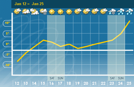
Monday, January 4, 2010
2009 Summary
We didn’t see any really big extremes this year in the local weather, so the big weather story of the year would be the lack of summer-like temperatures. Between late June and early August it never went above 27°C for 44 days. The only time we experienced summer-like weather was during a single week in June and a couple more in August.
However, take note that I never said that the lack of really warm temperatures was either good or bad, one thing I have learned over the years is that weather is very subjective and what one person considers a bad weather day is for someone else the most glorious day. Take for example this summer when even with the lack of hot weather, a poll on the weather station blog showed that 66% of people thought the weather was either good or great during the summer.
Looking at the graph for temperature there is a lot of green and not a lot of red or blue. Overall it was 0.06 degrees below average for the year which is close enough to put it into the average range. This makes it the coldest year since 2003 and only the second one that was even a little below the 1971-2000 average in the 11 complete years of record at the University of Waterloo weather station.
The year started off with a very cold January (the 6th coldest since records began back in 1915) but the rest of the winter and the early spring were warm. But then the middle of the year cooled off with July coming in as the 2nd coldest since 1915. It was interesting that the daily high temperatures for July were higher in Whitehorse than they were here.
After August it was generally pretty warm except for a couple of cold streaks in late August and mid-October. Only October came in a bit below average while November was the warmest since 2001 at almost 3 degrees above average. There was a stretch of 27 straight days starting in November with above average daytime highs.
The first four months of the year were very wet, with April being the wettest since 1996 and the 5th wettest since records began. Although we weren’t exactly in drought conditions for the next 5 months, each one was a little below average. Thus when we hit the driest part of the year in September, a stretch of only 15.3 mm in 27 days, the total for the year was back in the average range. If the largest single day precipitation of the year had not come on the 28th September, it would have been close to a record dry month.
A wet October was then offset by a very dry November (the driest month of 2009) so that in the end, the final total precipitation of 899.1 mm was achingly close to the average of 904.0 mm. This comes after a very dry year in 2007 (671.9 mm) and a very wet year in 2008 (1159.5 mm).
Although the 2008-09 snowfall season was tied for the third highest of all time, after January’s impressive 62.5 cm the rest of that winter and the beginning of the 2009-2010 winter have been relatively snow free. Thus for the calendar year of 2009 the snow total is only 128 cm, much less than the average of 159.5 cm.
Notable weather days of 2009:
January 16: The last day of a really cold freeze where the temperature didn’t go above -10°C for over 3 days. On the 16th, with the high temperature of only -15.1°C, it was the lowest high temperature in almost 2 years.
April 7: Final snowfall of the season that had a total of 235.0 cm. This season tied with 1942-1943 as the third highest total of all time behind both the 245.3 cm in 1923-24 and the 257.5 cm in 2007-08.
April 24-25: After a chilly start to the day at 4.6°C the temperature went above 20°C by noon on the 24th and 23.6°C by the afternoon, it then started getting colder in the evening down to 13°C, but around midnight we saw the largest 15 minute temperature rise of the year of 4.2 degrees between 11:45 pm and midnight. It got warmer the next day with another high of 26°C, however between 3:45 and 4:45 pm the temperature dropped 10.1 degrees (a record at the UW weather station). I just thought it was interesting that the biggest temperature rise and drop happened on consecutive days.
July: It was the second coldest July since records in the area began in 1915. We only had 2 days during the month where the high temperature was above average, so that made for 29 below average days.
July 7: The high temperature only got up to 15.9°C. That was the lowest daytime July high temperature since 1997 and the fifth lowest since 1971.
August 17: The temperature only got down to 21.8°C, it was the warmest night since August 1st, 2006 when it only went down to 25.3°C.
September 28: The wettest single day of the year at 30.2 mm, although most of it (21.2 mm) came down between 6:45 and 8:15 am with the rest coming in a couple of smaller downpours in the afternoon.
October 11: Sometimes the first frost day just kind of skirts below zero for a few 15 minute readings. But this time the temperature stayed below zero for a good 11 hours starting on the night of the 11th.
December 4: It only got up to 0.3°C which was below average for the day. That broke a streak of 27 straight days of above average daytime highs.
Summary for 2009 (averages from 1971-2000 data for the Waterloo Wellington Airport):
Average Daily High Temperature: 11.67 °C (average 11.89 °C)
Average Daily Low Temperature: 1.80 °C (average 1.71 °C)
Total Precipitation: 899.1 mm (average 904.0 mm)
Extremes for 2009 (all time UW weather station extreme in brackets):
Highest Temperature:
31.3 °C June 24 5:30 pm (35.4°C Aug 8, 2001 4:30 pm)
Highest Humidex:
44.3 Aug 9 6:00 pm (46.8 Aug 2, 2006 3:45 pm)
Lowest Temperature:
-28.8 °C Jan 15 8:15 am (-32.3 °C Jan 27, 2005 7:45 am)
Lowest Windchill:
-29.9 Jan 17, 6:45 am (-37.2 Jan 14, 1999 4:15 am)
Greatest temperature drop in 15 minutes:
-4.9 °C Apr 25 4:30 pm (-5.7 °C June 8, 2007 4:00 pm)
Greatest temperature drop in 60 minutes:
-10.1 °C Apr 25 3:45-4:45 pm (New Extreme)
Greatest temperature rise in 15 minutes:
Tie – 4.2 °C Feb 5 9:30 am and Apr 24 11:45 pm (8.6°C Jan 2, 2001 6:15 am)
Greatest temperature rise in 60 minutes:
9.1 °C Feb 5 8:45 - 9:45 am (12.2°C Jan 2, 2001 4:45-5:45 am)
Highest Precipitation in 15 minutes:
15.4 mm July 11 9:00-9:15 am (23.0 mm July 22 7:30-7:45 pm)
Highest Precipitation in 60 minutes:
16.4 mm Sep 28 7:30 - 8:30 am (36.7 mm Jun 16, 1998 1:15-2:15 pm)
Highest Precipitation in 1 day:
30.2 mm Sep 28 (78.0 mm July 11)
Highest 15 minute average wind speed:
33.2 km/h Dec 9 8:15 pm (44.6 km/h March 9, 2002 6:30 pm)
Last time the temperature went below 0 before the summer:
May 18 3:30 am (Has ranged between Apr 29- May 21)
First time the temperature went below 0 after the summer:
Oct 11 9:45 pm (Has ranged between Oct 2-28)
Highest daily low temperature:
21.8 °C Aug 17 (25.3 °C Aug 1, 2006)
Lowest daily high temperature:
-15.1 °C Jan 16 (-16.1 °C Jan 9, 2004)
Largest daily temperature range:
20.4 °C Feb 7 (29.6 °C Feb 19, 2007)
Smallest daily temperature range:
2.4 °C Nov 20 (0.45 °C Dec 7, 2005)
Click on the image below to see the temperature chart:

Click on the image below to see the precipitation chart:

However, take note that I never said that the lack of really warm temperatures was either good or bad, one thing I have learned over the years is that weather is very subjective and what one person considers a bad weather day is for someone else the most glorious day. Take for example this summer when even with the lack of hot weather, a poll on the weather station blog showed that 66% of people thought the weather was either good or great during the summer.
Looking at the graph for temperature there is a lot of green and not a lot of red or blue. Overall it was 0.06 degrees below average for the year which is close enough to put it into the average range. This makes it the coldest year since 2003 and only the second one that was even a little below the 1971-2000 average in the 11 complete years of record at the University of Waterloo weather station.
The year started off with a very cold January (the 6th coldest since records began back in 1915) but the rest of the winter and the early spring were warm. But then the middle of the year cooled off with July coming in as the 2nd coldest since 1915. It was interesting that the daily high temperatures for July were higher in Whitehorse than they were here.
After August it was generally pretty warm except for a couple of cold streaks in late August and mid-October. Only October came in a bit below average while November was the warmest since 2001 at almost 3 degrees above average. There was a stretch of 27 straight days starting in November with above average daytime highs.
The first four months of the year were very wet, with April being the wettest since 1996 and the 5th wettest since records began. Although we weren’t exactly in drought conditions for the next 5 months, each one was a little below average. Thus when we hit the driest part of the year in September, a stretch of only 15.3 mm in 27 days, the total for the year was back in the average range. If the largest single day precipitation of the year had not come on the 28th September, it would have been close to a record dry month.
A wet October was then offset by a very dry November (the driest month of 2009) so that in the end, the final total precipitation of 899.1 mm was achingly close to the average of 904.0 mm. This comes after a very dry year in 2007 (671.9 mm) and a very wet year in 2008 (1159.5 mm).
Although the 2008-09 snowfall season was tied for the third highest of all time, after January’s impressive 62.5 cm the rest of that winter and the beginning of the 2009-2010 winter have been relatively snow free. Thus for the calendar year of 2009 the snow total is only 128 cm, much less than the average of 159.5 cm.
Notable weather days of 2009:
January 16: The last day of a really cold freeze where the temperature didn’t go above -10°C for over 3 days. On the 16th, with the high temperature of only -15.1°C, it was the lowest high temperature in almost 2 years.
April 7: Final snowfall of the season that had a total of 235.0 cm. This season tied with 1942-1943 as the third highest total of all time behind both the 245.3 cm in 1923-24 and the 257.5 cm in 2007-08.
April 24-25: After a chilly start to the day at 4.6°C the temperature went above 20°C by noon on the 24th and 23.6°C by the afternoon, it then started getting colder in the evening down to 13°C, but around midnight we saw the largest 15 minute temperature rise of the year of 4.2 degrees between 11:45 pm and midnight. It got warmer the next day with another high of 26°C, however between 3:45 and 4:45 pm the temperature dropped 10.1 degrees (a record at the UW weather station). I just thought it was interesting that the biggest temperature rise and drop happened on consecutive days.
July: It was the second coldest July since records in the area began in 1915. We only had 2 days during the month where the high temperature was above average, so that made for 29 below average days.
July 7: The high temperature only got up to 15.9°C. That was the lowest daytime July high temperature since 1997 and the fifth lowest since 1971.
August 17: The temperature only got down to 21.8°C, it was the warmest night since August 1st, 2006 when it only went down to 25.3°C.
September 28: The wettest single day of the year at 30.2 mm, although most of it (21.2 mm) came down between 6:45 and 8:15 am with the rest coming in a couple of smaller downpours in the afternoon.
October 11: Sometimes the first frost day just kind of skirts below zero for a few 15 minute readings. But this time the temperature stayed below zero for a good 11 hours starting on the night of the 11th.
December 4: It only got up to 0.3°C which was below average for the day. That broke a streak of 27 straight days of above average daytime highs.
Summary for 2009 (averages from 1971-2000 data for the Waterloo Wellington Airport):
Average Daily High Temperature: 11.67 °C (average 11.89 °C)
Average Daily Low Temperature: 1.80 °C (average 1.71 °C)
Total Precipitation: 899.1 mm (average 904.0 mm)
Extremes for 2009 (all time UW weather station extreme in brackets):
Highest Temperature:
31.3 °C June 24 5:30 pm (35.4°C Aug 8, 2001 4:30 pm)
Highest Humidex:
44.3 Aug 9 6:00 pm (46.8 Aug 2, 2006 3:45 pm)
Lowest Temperature:
-28.8 °C Jan 15 8:15 am (-32.3 °C Jan 27, 2005 7:45 am)
Lowest Windchill:
-29.9 Jan 17, 6:45 am (-37.2 Jan 14, 1999 4:15 am)
Greatest temperature drop in 15 minutes:
-4.9 °C Apr 25 4:30 pm (-5.7 °C June 8, 2007 4:00 pm)
Greatest temperature drop in 60 minutes:
-10.1 °C Apr 25 3:45-4:45 pm (New Extreme)
Greatest temperature rise in 15 minutes:
Tie – 4.2 °C Feb 5 9:30 am and Apr 24 11:45 pm (8.6°C Jan 2, 2001 6:15 am)
Greatest temperature rise in 60 minutes:
9.1 °C Feb 5 8:45 - 9:45 am (12.2°C Jan 2, 2001 4:45-5:45 am)
Highest Precipitation in 15 minutes:
15.4 mm July 11 9:00-9:15 am (23.0 mm July 22 7:30-7:45 pm)
Highest Precipitation in 60 minutes:
16.4 mm Sep 28 7:30 - 8:30 am (36.7 mm Jun 16, 1998 1:15-2:15 pm)
Highest Precipitation in 1 day:
30.2 mm Sep 28 (78.0 mm July 11)
Highest 15 minute average wind speed:
33.2 km/h Dec 9 8:15 pm (44.6 km/h March 9, 2002 6:30 pm)
Last time the temperature went below 0 before the summer:
May 18 3:30 am (Has ranged between Apr 29- May 21)
First time the temperature went below 0 after the summer:
Oct 11 9:45 pm (Has ranged between Oct 2-28)
Highest daily low temperature:
21.8 °C Aug 17 (25.3 °C Aug 1, 2006)
Lowest daily high temperature:
-15.1 °C Jan 16 (-16.1 °C Jan 9, 2004)
Largest daily temperature range:
20.4 °C Feb 7 (29.6 °C Feb 19, 2007)
Smallest daily temperature range:
2.4 °C Nov 20 (0.45 °C Dec 7, 2005)
Click on the image below to see the temperature chart:
Click on the image below to see the precipitation chart:
Saturday, January 2, 2010
December 2009 Summary
An average month for temperature and precipitation
It was a very steady month for temperature with only 5 days that were either 5 degrees above or below average. With the daily high temperatures being 0.4 degrees below average and the daily low temperatures at 0.6 degrees above the overall temperature was 0.1 above average. However this is still within the average range.
Looking at the graph you can also see how little the temperature went up and down with the diurnal cycle (ie. daily), but went up and down over the course of a few days. This is reflective of the large numbers of overcast days during the month when the temperature is not affected by the sun but rather by large weather systems moving through the area.
Of the 79.6 mm of precipitation during the month, about 48 of them fell in the first 10 days which shows that the rest of the month was pretty dry. The average precipitation for the month is 71.1 mm so this month was at the top end but still within the average range.
We had a little over 30 cm of snow this month which wasl a bit below the average of 38.5 cm.
Summary for December 2009:
Maximum Temperature 9.2 C
Minimum Temperature -17.3 C
Average Daily High Temperature -0.7 C (Long term average -0.4 C)
Average Daily Low Temperature -6.9 C (Long term average -7.5 C)
Total Precipitation 79.6 mm (Long term average 71.1 mm)
(Long term averages based on 1971-2000 data for the Waterloo Wellington Airport)
Sign up to get the monthly weather station summary by e-mail
Subscribe to:
Posts (Atom)


