A cold May with average precipitation
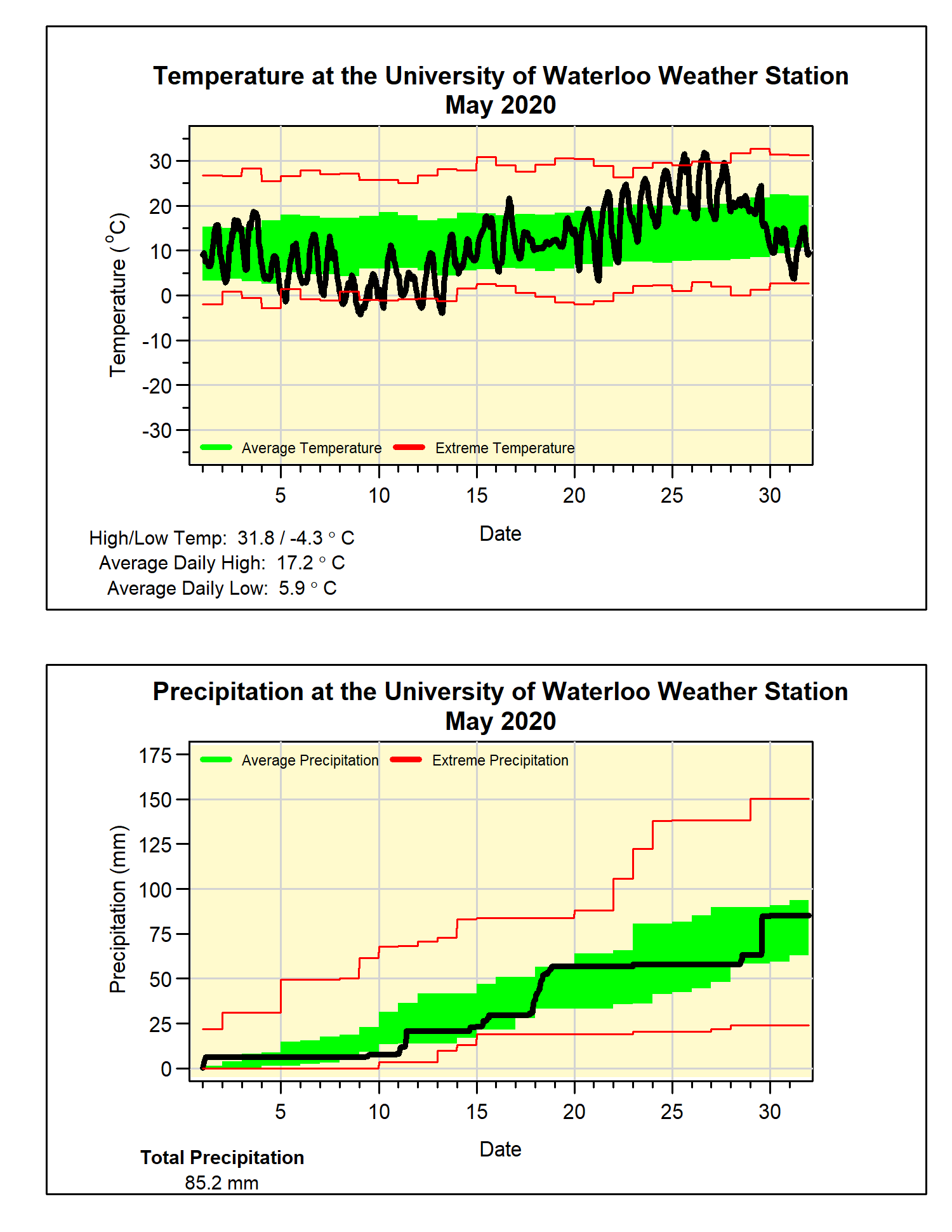
Clearly it was a very cold start to the month, followed by some very hot temperatures (more on that later). But we didn’t see enough of the warmth to make up for the cold start, so overall the month was 0.9 degrees below average, making it the coldest May since 2008.
Part of the cold start to the month saw the temperature go down to -4.3°C on May 9, which was tied for the 3rd lowest May temperature in the 100+ year history of weather records in the region. Then on May 26, the high temperature of 31.8°C, was the 5th warmest day in May on record. OK I know this one is a stretch, but the temperature range of 36.1 degrees was the second largest range in May temperatures we have seen in the region.
As well, it was not only the latest date (May 16) for the winner of the UW Weather Station Contest (when the temperature goes above 20°C), but it was the latest 20°C day in the last 100 years (previous record May 13 in 1919).
A storm late in the month that brought us 21.6 mm of rain in one day put the total precipitation up to 85.2 mm, just above the average of 82.3 mm. The total for the year so far of 426.7 mm is well above the average of 340.2 mm.
So can we finally call an end to the snow season! The 5.5 cm of snow on May 11th was quite a surprise that late in the month, but it was not the latest snow in the region, as back on May 18, 1923 there is a reading of 9 cm. With the snow we did get in May, the total for the 2019-20 snowfall season was 159.5 cm, as close as you can get to the average of 159.7 cm.
Summary for May 2020:
Maximum Temperature 31.8°C
Minimum Temperature -4.3°C
Average Daily High Temperature 17.2°C (Long term average 18.5°C)
Average Daily Low Temperature 5.9°C (Long term average 6.4°C)
Total Precipitation 85.2 mm (Long term average 82.3 mm)


