A cold April with just barely average precipitation
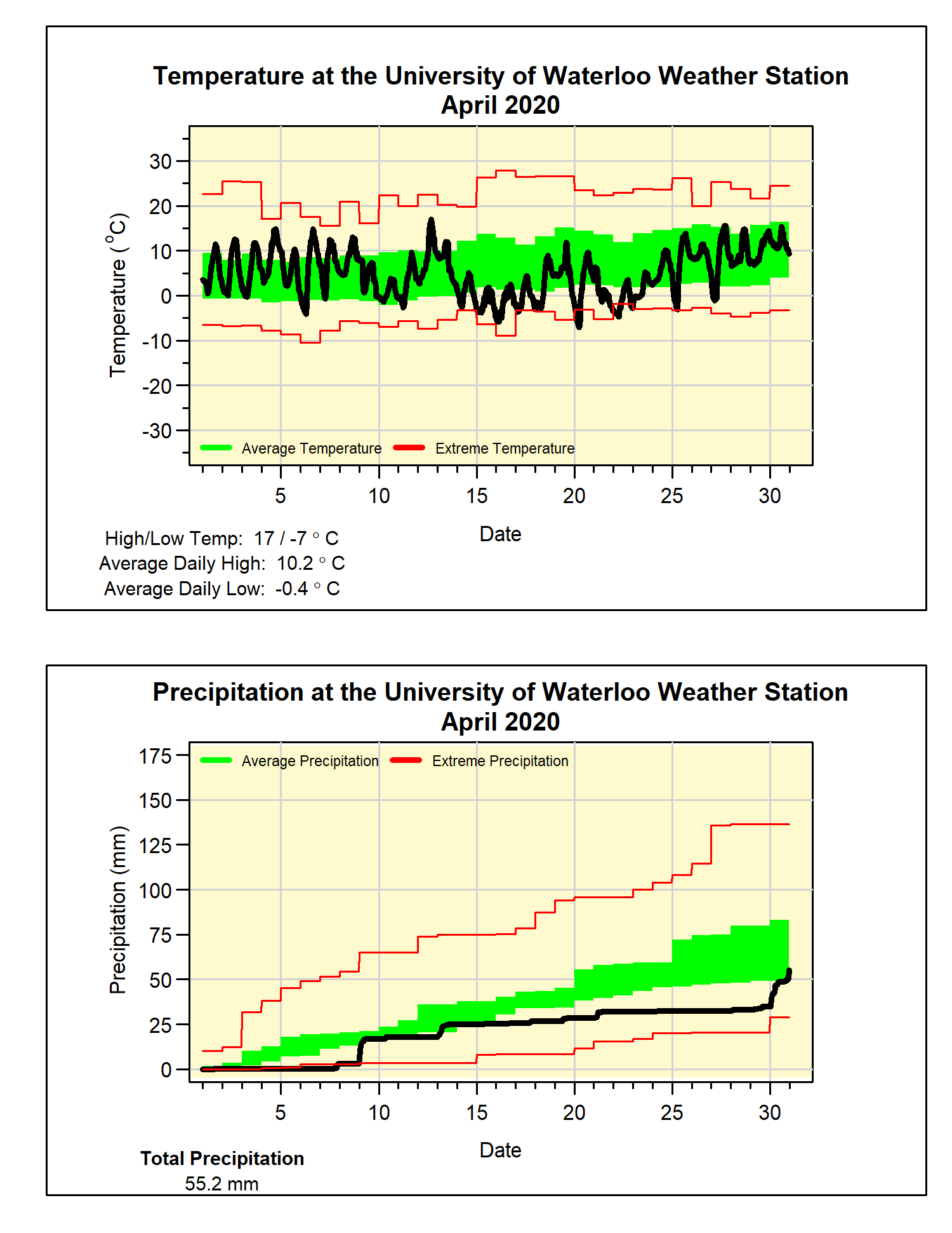
The warmth of March carried on into the first week of April, but after that, there was a two week stretch of cold temperatures. Even though it warmed up a bit right at the end of the month, the overall temperature was still a little over a degree colder than average.
This was the first colder than average month since November of last year, as well it means that 4 of the last 5 Aprils have been colder than average. Also, the highest temperature for the month was only 17.0°C, the last time it didn’t get warmer than that during April was back in 1995.
If it wasn’t for the 20 mm of rain we got on the last day of the month, it would have been a drier than average April. But that last day brought the total up to 55.2 mm, below the average of 74.5 mm, but enough to just get it into the average range.
At the end of April, the total for the year of 341.5 is still well above the 264.4 mm we would expect for the first four months of the year.
The only measurable snow during the month was one day with 1.5 cm, this put the total for the snowfall season at 153.5 cm, very close to the average of 159.7 cm.
Summary for April 2020:
Maximum Temperature 17.0°C
Minimum Temperature -7.0°C
Average Daily High Temperature 10.2°C (Long term average 11.5°C)
Average Daily Low Temperature -0.4°C (Long term average 0.8°C)
Total Precipitation 55.2 mm (Long term average 74.5 mm)


No comments:
Post a Comment