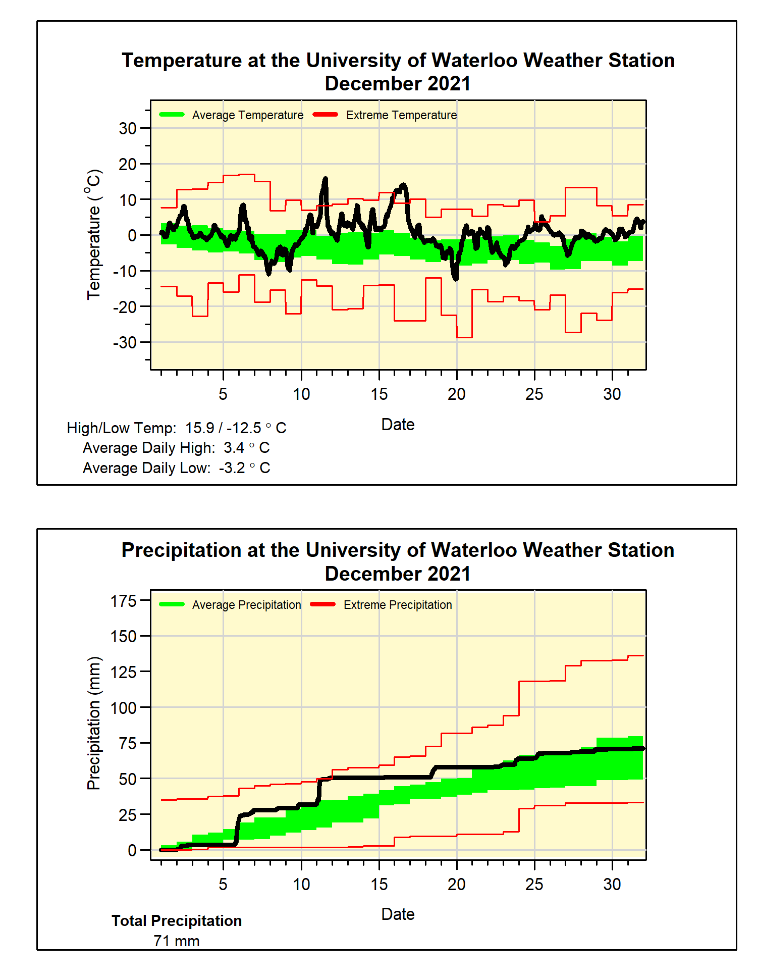
A very warm December with average precipitation
With only 5 colder than average days and lots of warm ones, December was 3.4 degrees above average. This made it the warmest since 2006 and the fourth warmest since records began in the region a little over 100 years ago. The high temperature of 15.9°C on the 11th was the fifth hottest December day on record, and the last time it was it was that hot in December was Dec 5, 2001 when it was 16.7°C.
It was pretty wet the first half of the month, but then dried out for the second half. This resulted in a total precipitation of 71.0 mm, which is almost exactly the average of 71.2 mm. However, the warm temperatures results in only 28.9 cm of snow compared to the average of 37.2 cm for December.
Summary for December 2021:
Maximum Temperature 15.9°C
Minimum Temperature -12.5°C
Average Daily High Temperature 3.4°C (Long term average 0.2°C)
Average Daily Low Temperature -3.2°C (Long term average -6.8°C)
Total Precipitation 71.0 mm (Long term average 71.2 mm)


No comments:
Post a Comment