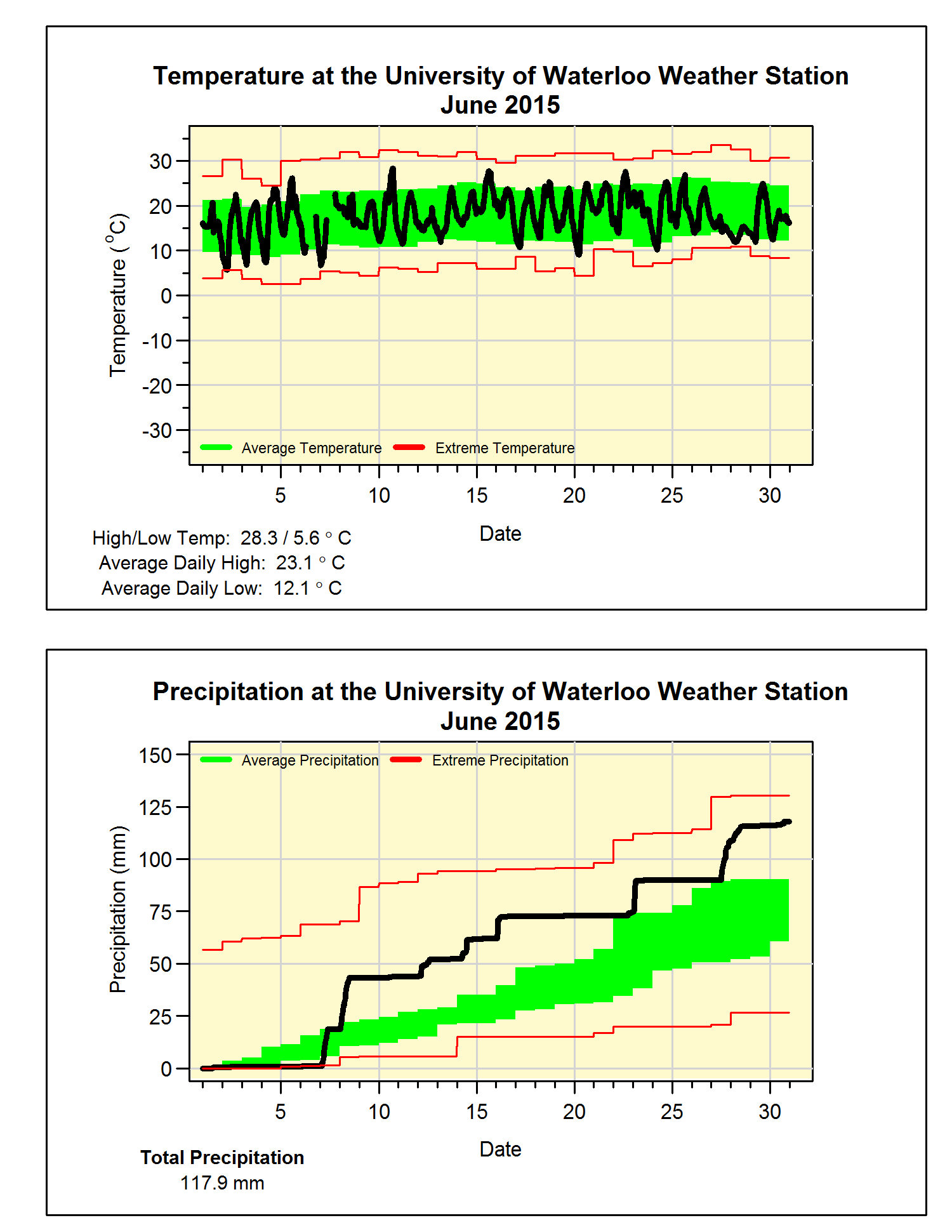
A very wet June with average temperature
About as average of a month for temperature as you can have with just a few colder and a few warmer than average days. Overall, it was a mere 0.1 degree above average, but this was still the coldest June we have seen in the region since 2009.
It was a very wet month with 4 days over 15.0 mm along with 18 days of some precipitation compared to the average of 11.5. The total of 117.9 mm was much more than the long-term average of 82.4 mm well outside the average range, but we only have to go back to a couple of years to find a wetter month of June. Another interesting thing that I found out was that it is month of extremes, in the last 10 years only once has the total precipitation been in the average range, the rest were either very dry or very wet.
This soggy month put the total precipitation we have seen this year (378.2 mm) closer to the average (416.1 mm).
Summary for June 2015:
Maximum Temperature 28.3°C
Minimum Temperature 5.6°C
Average Daily High Temperature 23.1°C (Long term average 23.6°C)
Average Daily Low Temperature 12.1°C (Long term average 11.5°C)
Total Precipitation 117.9 mm (Long term average 82.4 mm)
(Long term averages based on 1981-2010 data for the Waterloo Wellington Airport)