A warm and very wet October
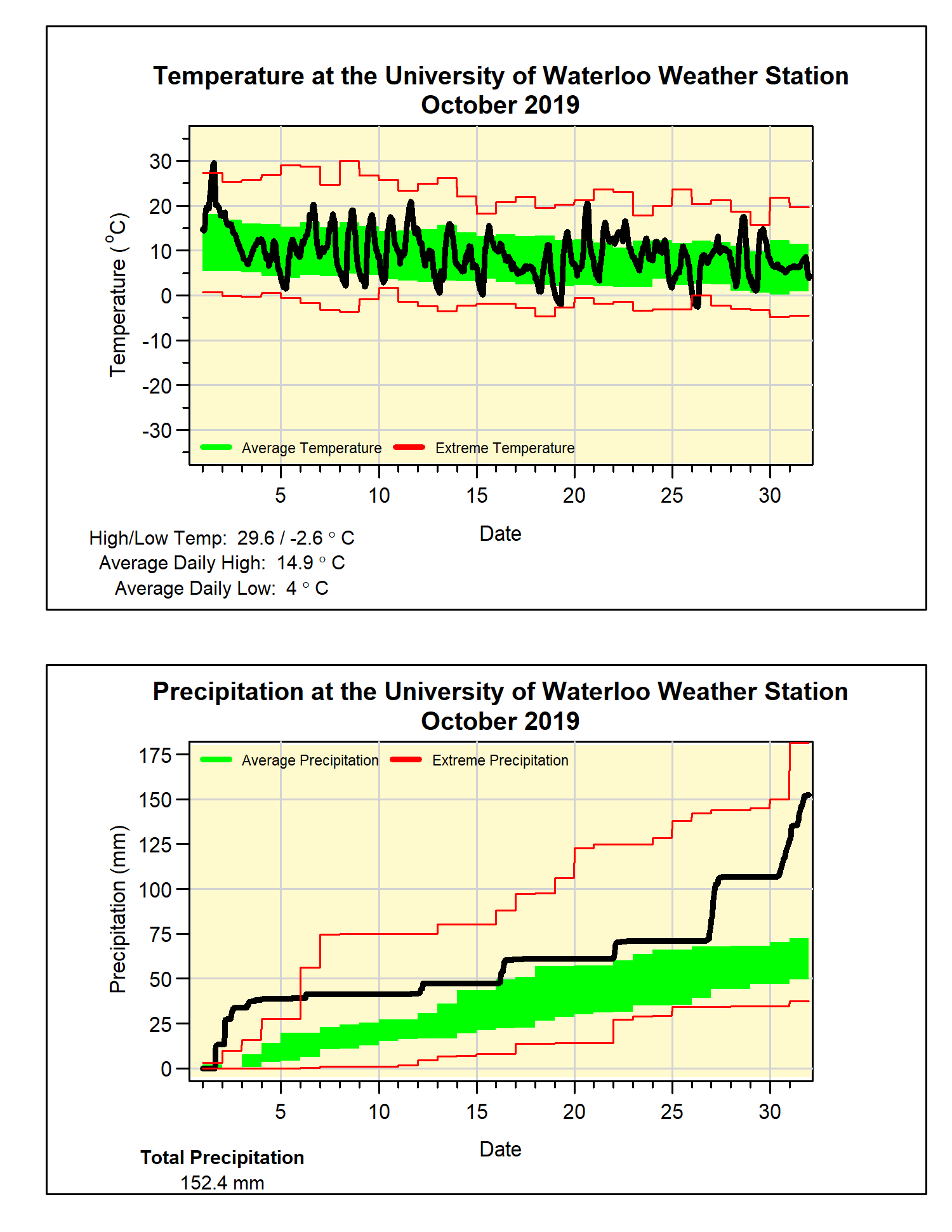
The month started off with a daily high temperature near 30°C (29.6°C to be exact), which was only the third time there has been a day of at least 30°C during the month of October in the over 100 years of weather data in the region. The others were: Oct 8, 2007 (30.3°C) and Oct 6, 1946 (31.1°C).
This was followed by almost a week of temperatures in the low 20s to high teens, which was still warmer than average for that time of year. With the rest of the month seeing average temperatures, the overall temperature for October was 1.2 degrees higher than average and we have now seen 4 months in a row with above average temperatures.
The temperature first went below zero on October 19th at 12:45 am, which is about a week later than the average for the 20 years of the UW Weather Station. It also puts the frost-free period for 2019 at 173 days, about 12 days longer than the average.
During the last week of the month there were 3 days with over 20 mm of precipitation, in fact just that week would have resulted in average precipitation. Combined with the rest of the month the total precipitation of 152.4 mm was more than twice the average of 67.4 mm and the most in the last 6 years.
This wet month resulted in the total precipitation for the year (813.2 mm) going well above the average for this time of year (750.6 mm).
Summary for October 2019:
Maximum Temperature 29.6°C
Minimum Temperature -2.6°C
Average Daily High Temperature 14.9°C (Long term average 13.5°C)
Average Daily Low Temperature 4.0°C (Long term average 2.9°C)
Total Precipitation 152.4 mm (Long term average 67.4 mm)