Another hot and dry month
At over one and half
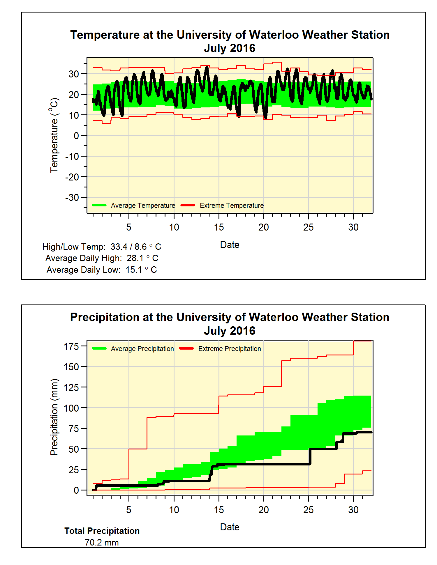
degrees above average, it was definitely a hot month.
With not much else
so say about the heat this month let’s have a couple of fun facts for the summer
so far:
The last time the
daily high temperature was more than 5 degrees below average was back on June
13th. So far we have seen 22 days above 30 degrees, on average we
only see 8 of them during a typical year, but we still have a long way to go to
beat the record of 49 back in 1955.
For the third month in a row the precipitation was below
average. Although it might have been
much worse as it was only in the last week of the month that we saw almost 40
mm of the 70 mm precipitation for July.
But as was typical of the type of storms we have seen this summer, most
of the rain fell in short bursts lasting less than an hour, and this means a
lot of it probably ran off without having time to soak into the ground.
The total precipitation for the year (485.0 mm) has now
started to drop below the average for this time of the year (509.0 mm).
Summary for July 2016:
Maximum Temperature 33.4°C
Minimum Temperature 8.6°C
Average Daily High Temperature 28.1°C (Long term average
26.0°C)
Average Daily Low Temperature 15.1°C (Long term average 14.0°C)
Total Precipitation 70.2 mm (Long term average 98.6 mm)
(Long term averages based on 1981-2010 data for the Waterloo Wellington Airport)