Although we are scheduled to get some rain tonight and over the next few days it still looks like it may be one of the driest July every recorded in the area.
As of the 27th we have only had about 3.5 mm for the month, this is more than the incredibly dry July of 1916 when we only had 1.8 mm. To get second we have to have less than the 19.8 mm seen in 1919.
Wednesday, July 27, 2011
Tuesday, July 26, 2011
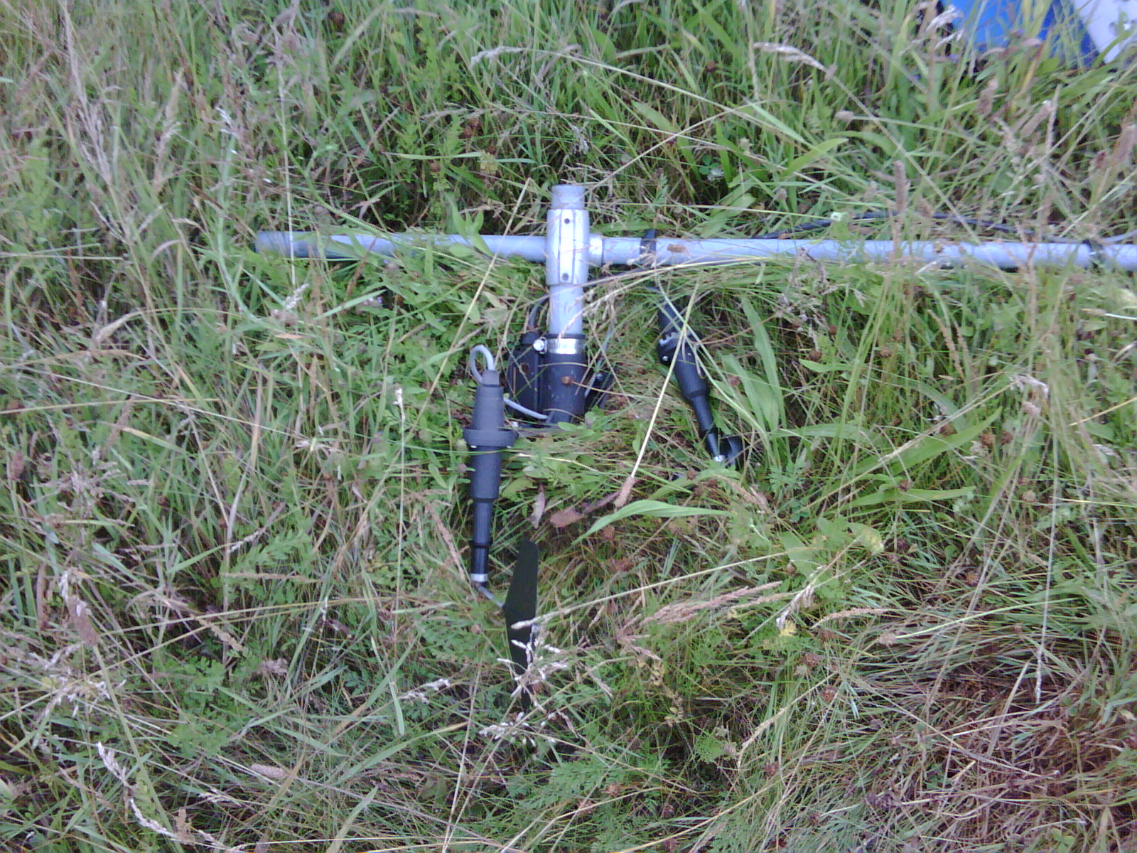
Weather Station Damaged
Now that all the reports have been filed I can reveal that the reason the weather station has been giving us strange readings is that the station was vandalized during the evening of July 16th. The fenced off area containing the station was entered and main tower was pulled down:

We were lucky that the battery had enough power to keep the station going for the days when the solar panel was facing the ground and not charging.
It was very bad timing as during the week when we had the hottest temperatures in the past many years we were not able to get an accurate reading. This was because the temperature sensor was on its side and thus was getting hit with direct solar radiation after about noon. This caused the temperature to spike up much higher than it would have been "in the shade".
Here is the reason that the wind speed was zero:
The good news is that the station is pretty much back up, except for some quick fixes to the anemometers which will have to be replaced eventually.
Let's hope this is the one and only time I'll have to deliver news like this.
Tuesday, July 19, 2011
Equipment Problems
As many people have noticed the temperature sensor is giving unrealistic readings during these days of very high temperatures.
We are working at trying to fix the problem.
We are working at trying to fix the problem.
Sunday, July 3, 2011
June 2011 Summary
Average temperatures for June and the first dry month of the year
Nothing too spectacular about the temperature in June, a few hot days at the beginning and a few cool days after that made for overall temperature that was just 0.3 degrees warmer than what we would expect putting it within the average range.
For the first time this year it was a drier than average month. Although it wasn’t drier by much as we had 60.4 mm and the average range starts at 64 mm. There was only one really wet day of the month, the 22nd when 28.2 mm fell, and there was a dry stretch from the 9th to the 20th.
Even with the relatively dry month, we still had 602.0 mm for the first half of the year which is well above the average of 415.0 mm. This is the second wettest first half of the year in the area since records began back in 1914. Only in 1947 was it wetter when 624.8 mm was recorded from January to June.
Summary for June 2011:
Maximum Temperature 32.0°C
Minimum Temperature 5.6°C
Average Daily High Temperature 23.2°C (Long term average 23.6°C)
Average Daily Low Temperature 12.2°C (Long term average 11.3°C)
Total Precipitation 60.4 mm (Long term average 80.0 mm)
(Long term averages based on 1971-2000 data for the Waterloo Wellington Airport)

Sign up to get the monthly weather station summary by e-mail
Subscribe to:
Posts (Atom)


