A very wet and warm October
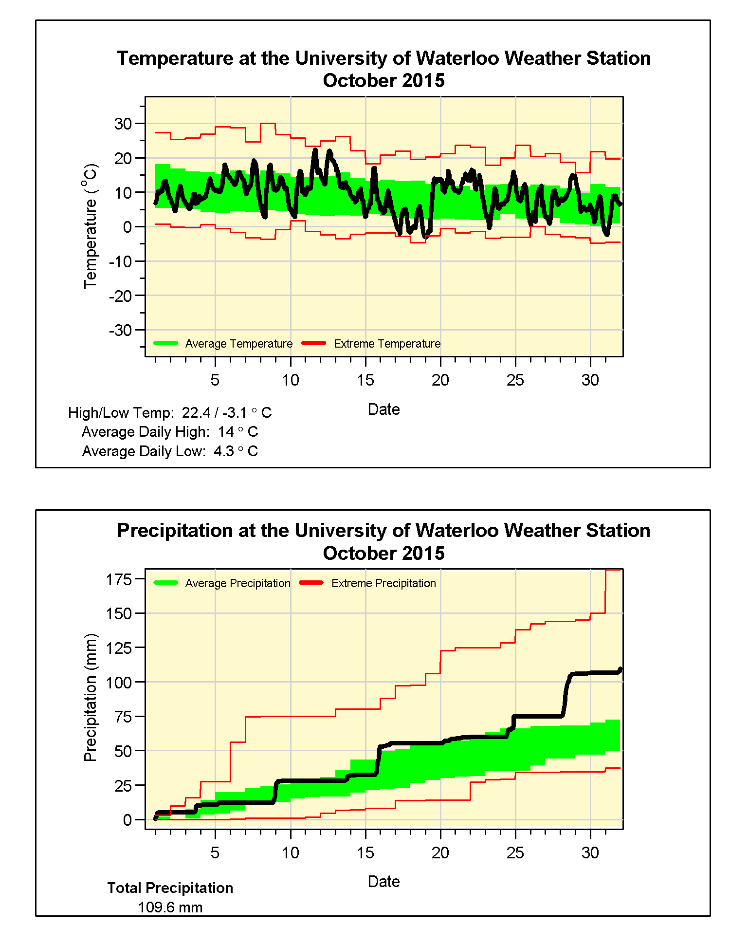
Although it never really got that hot, there were only a couple of days over 20 C, the overall temperature for the month was almost a degree above average. But incredibly this makes it the coldest October in the last 6 years as in those years it has consistently been more than a degree above average. On the graph you can also see when the temperature went up over 15 degrees in just under 6 hours on the 19th.
We saw a lot of precipitation late in the month with 30.8 mm on the 28th, however it still would have been an above average month even if that had not have happened. The total of 109.6 mm was well above the average of 67.4 mm.
A wetter month puts the total so far this year of 679.8 mm a little closer to the average for the end of October of 750.6 mm.
Summary for October 2015:
Maximum Temperature 22.4°C
Minimum Temperature -3.1°C
Average Daily High Temperature 14.0°C (Long term average 13.2°C)
Average Daily Low Temperature 4.3°C (Long term average 2.9°C)
Total Precipitation 109.6 mm (Long term average 67.4 mm)
(Long term averages based on 1981-2010 data for the Waterloo Wellington Airport)


1 comment:
Thanks for the info. It's always great to see where we are in the grand scheme of things!
BTW, really missing the 15 minute daily break downs for at least the temperatures. Any chance of that coming back to the weather page?
Thanks!
Post a Comment