Another warm November with average precipitation
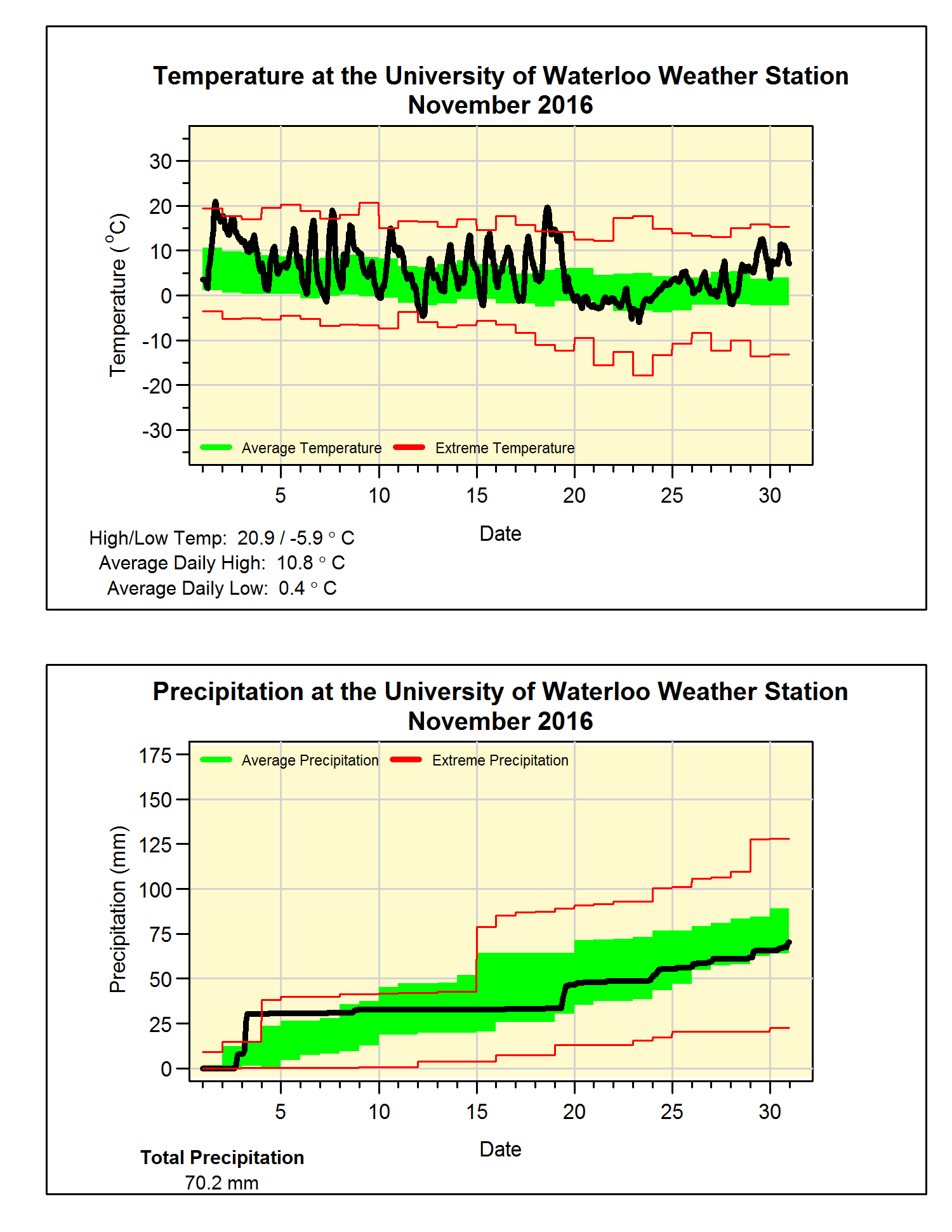
It turns out that this November was really close to last November in terms of both temperature and precipitation. For temperature it was just over 3 degrees above average, tying it with last year for 6th warmest since records began in the area 100 years ago.
First fun fact, although the overall temperature was only tied for 6th, there were lots of temperature variations between the daytime and nighttime temperatures at the start of the month. This resulted in the average of the daily high temperatures of 10.8°C coming in as the highest daily high temperatures for November.
Second fun fact, there were 20 days when the temperature was over 10°C in November, the highest number in the historical records in the region.
From the temperature graph you can see that the grey “Vancouver” weather started on the 20th with little variation between the daytime and nighttime temperatures.
The precipitation total was 70.2 mm (compared to 68.2 mm last year), although this is below the average of 87.1 mm, it is within the average range for November. The amount of precipitation for the year so far is 799.6 mm which is below the average of 832.9 mm. It also means that we only need about 50 mm in December to get within the average range for 2016.
And yes we have to start talking about snow, however, there was only 2.5 cm recorded compared to the November average of 13 cm.
Summary for November 2016:
Maximum Temperature 20.9°C
Minimum Temperature -5.9°C
Average Daily High Temperature 10.8°C (Long term average 6.3°C)
Average Daily Low Temperature 0.4°C (Long term average -1.4°C)
Total Precipitation 70.2 mm (Long term average 87.1 mm)
(Long term averages based on 1981-2010 data for the Waterloo Wellington Airport)


No comments:
Post a Comment