A very warm October with above average precipitation
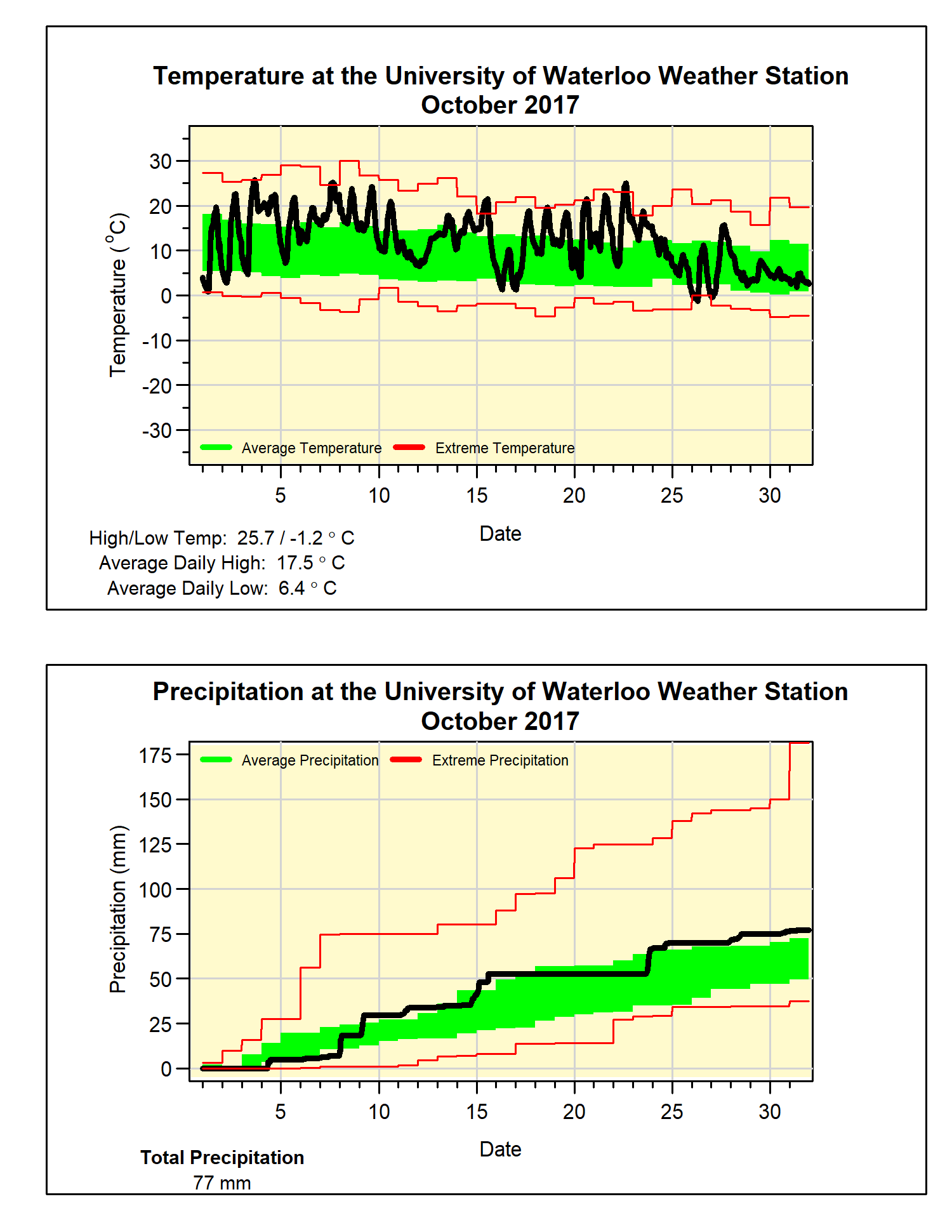
Most of October was really warm and if it wasn’t for the cooler temperatures in the last week it might have been one for the record books. As it was, the overall temperature was over 3.5 degrees above average making it the second warmest in almost 50 years (it was 5 degrees warmer than average in 2007).
We also saw 12 days in October where the temperature was over 20°C, we haven’t seen than many since October 1971. But the most significant day was the 22nd when the temperature topped out at 25°C, this was tied with 1947 as the latest day of the year with a temperature above 25°C in the over 100 years of weather records in the region (just for the record it got up to 25.6°C that day in 1947).
As we have seen in each of the 20 years of weather data at the UW Weather Station, the first day that it went below zero occurred in October. This year it first happened on the morning of October 26th, which is later than the recent average of the 13th. The resulting length of the frost-free season was 170 days, a little longer than the recent average of 160 days.
The 77.0 mm of precipitation was just enough above the average of 67.4 mm to put the month in the above average range. The total precipitation for the year is 890.4 mm is still well above the average of 750.6 mm.
Summary for October 2017:
Maximum Temperature 25.7°C
Minimum Temperature -1.2°C
Average Daily High Temperature 17.5°C (Long term average 13.5°C)
Average Daily Low Temperature 6.4°C (Long term average 2.9°C)
Total Precipitation 77.0 mm (Long term average 67.4 mm)


No comments:
Post a Comment