Thursday, August 7, 2014

July 2014 Summary

A cold and very wet July

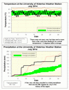
After a couple of warmer months, July went back to the colder temperatures we saw at the beginning of the year, in fact it was almost as if June and July switched places.  Although it was never cold for more than a few days in a row, there were also only a few warmer than average days.  Overall it was 1.3 degrees below average making it the coldest July since 2009.

There were not that many days that had precipitation, but when it did come down it came down hard.  First on the 7th almost 60 mm came down, then 23 mm on the 15th, and finally 40 mm between the 27th and 28th.  The total for the month was 165.7 mm, well above the average of 92.9 mm and the 5th wettest July we have seen in the region since records began 100 years ago.

This very wet month brought the total precipitation for the first half of the year (503.4 mm) back up very close to the average (509.0 mm).


Summary for July 2014:
Maximum Temperature 29.0°C
Minimum Temperature 8.7°C
Average Daily High Temperature 23.9°C (Long term average 26.0°C)
Average Daily Low Temperature 13.2°C (Long term average 13.8°C)
Total Precipitation 165.7 mm (Long term average 92.9 mm)

(Long term averages based on 1971-2000 data for the Waterloo Wellington Airport)
Sunday, July 6, 2014

June 2014 Summary

A warm and dry June

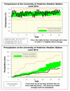
For the first time since October of last year it was a warmer than average month.  It never got extremely hot (only one day above 30°C) but there were enough warm days to make the overall temperature 1.7 degrees higher than average.

Although we had the average of 12 days with some precipitation and that precipitation was very hard at times, there was only day with more than 10 mm.  The total of 52.3 mm was well below the average of 80.0 mm for June.

As only 2 of the first 6 months of 2014 had above average precipitation, it is no surprise that the total for the year so far of 332.1 mm is below the average of 416.1 mm.


Summary for June 2014:
Maximum Temperature 30.1°C
Minimum Temperature 7.1°C
Average Daily High Temperature 25.2°C (Long term average 23.6°C)
Average Daily Low Temperature 13.0°C (Long term average 11.3°C)
Total Precipitation 52.3 mm (Long term average 80.0 mm)

(Long term averages based on 1971-2000 data for the Waterloo Wellington Airport)

Sunday, June 22, 2014

Spring 2014 Summary

The coldest Spring in 30 years with average precipitation

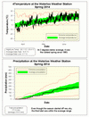
The season started out very cold for most of the first half and then was closer to average in the second half.  Overall it was 2 degrees below average, making it the coldest Spring since 1983.

Although the Spring started off dry, the rest of the season was wetter with the total coming in on the low end of the average range.

Summary for Spring 2014:
Maximum Temperature 28.1 °C
Minimum Temperature -16.4 °C
Average Daily High Temperature 13.6 °C (Long term average 15.9 °C)
Average Daily Low Temperature 2.7 °C  (Long term average 4.4 °C)
Total Precipitation 171.0 mm (Long term average 219.5 mm)

(Long term averages based on 1971-2000 data for the Waterloo Wellington Airport)


Monday, June 9, 2014

May 2014 Summary

May was just within the average range for both temperature and precipitation 

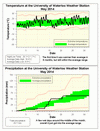
The daily high temperatures of May were just a little below average while the daily low temperatures were 1.4 degrees higher than average. As a result, the overall temperature was higher than average for the first time in 6 months (but as it was only 0.6 degrees above, it was still within the average range).

Also on the edge of the average range was the precipitation (63.6 mm) for the month, but this time on the low end of the range. About 40 mm of this precipitation came down between the 13th and the 15th while hardly any fell after the 21st.

So far this year we have seen 276.7 mm of precipitation which is below the average of 340.2 mm.


Summary for May 2014:
Maximum Temperature 28.1°C
Minimum Temperature 1.7°C
Average Daily High Temperature 18.8°C (Long term average18.9°C)
Average Daily Low Temperature 8.0°C (Long term average 6.6°C)
Total Precipitation 63.7 mm (Long term average 75.7 mm)


(Long term averages based on 1971-2000 data for the Waterloo Wellington Airport)
Friday, May 9, 2014

April 2014 Summary

Another cold month but with average precipitation

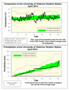
The overall temperature in April was just cold enough to make it below average, but it was the closest to the average in 6 months at 0.8 degrees lower.  Looking at the graph you can see the incredibly steady (almost) 48 hours drop in temperature from the high of 19.8°C on the14th to the low of -9.0°C on the 16th.

Up until the last two days it might have been a below average month for precipitation, but those two days pushed the total of 90.9 mm right to the top of the average range (the top of the range is 91.0 mm).  The total for the year so far is 214.7 mm which is somewhat below the average at this time of 264.4 mm.

The 3.5 cm of snow in April topped off the snowfall season at 167.5 cm, which was really not that much more than the average of 159.5 cm.  But, as has been previously noted it might have seemed like a lot more as we didn’t get a mid-winter thaw.


Summary for April 2014:
Maximum Temperature 22.3°C
Minimum Temperature -9.0°C
Average Daily High Temperature 10.6°C (Long term average 11.4°C)
Average Daily Low Temperature -0.2°C (Long term average 0.6°C)
Total Precipitation 90.9 mm (Long term average 76.9 mm)

(Long term averages based on 1971-2000 data for the Waterloo Wellington Airport)