Just like August, September was 3.3 degrees above average and just like the previous month it was also the 5th hottest in the 100 years of records in the region. But whereas last time we had to go back to 1959 to find a hotter month this time we only have to go back to last year when September was over 4 degrees above average.
This year there were a couple of days over 30 early in the month and there was another warm streak in the middle. For the last week the temperature really dropped and although it might have seemed a lot colder it actually just went down to the average.
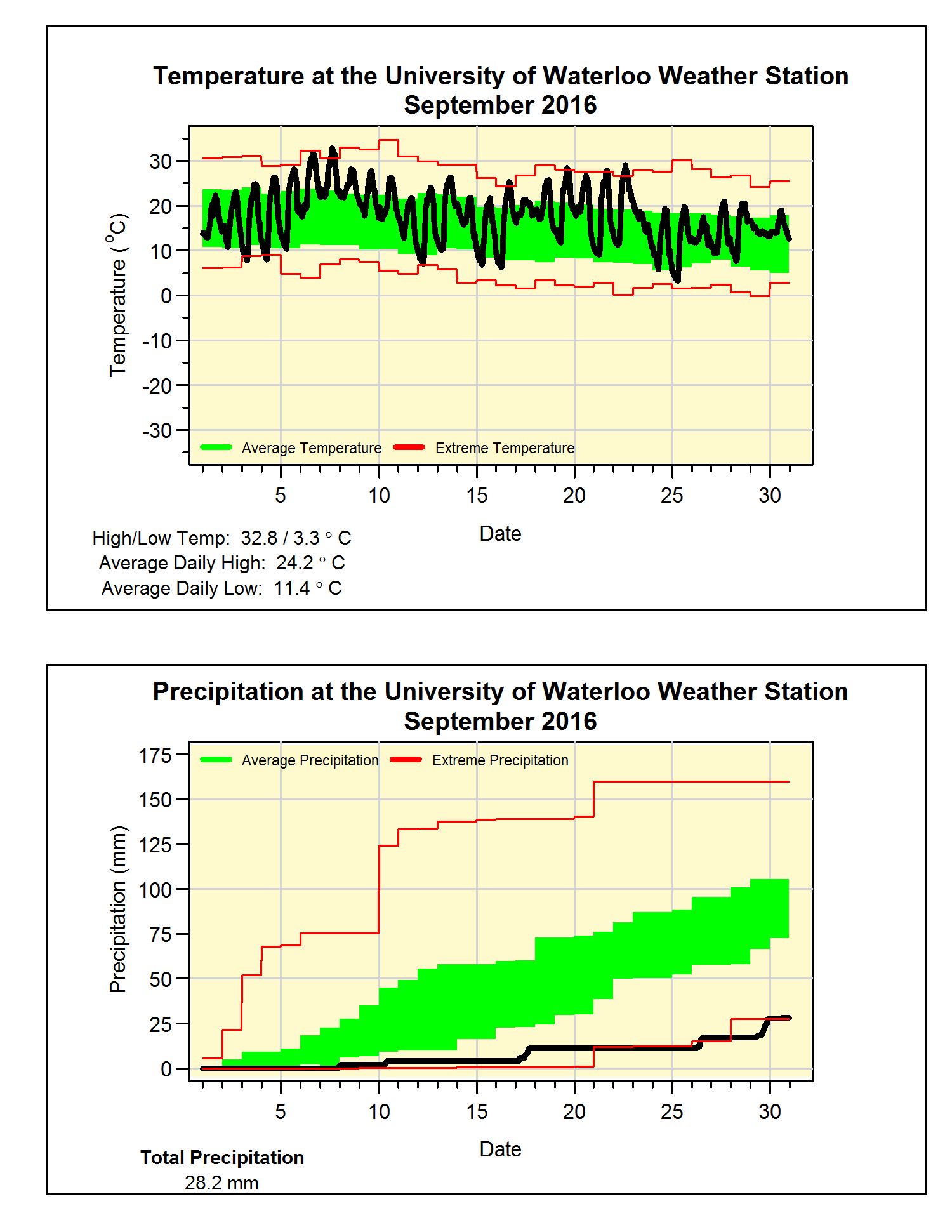
We might have to soon start using the D word again as this month only saw 28.2 mm of precipitation, this is less than a third of the average of 87.8 mm. The annual precipitation total has been jumping around the average all year and with this dry month we have gone under again (669.0 mm this year – 685.2 mm average).
Summary for September 2016:
Maximum Temperature 32.8°C
Minimum Temperature 3.3°C
Average Daily High Temperature 24.2°C (Long term average 20.4°C)
Average Daily Low Temperature 11.4°C (Long term average 8.6°C)
Total Precipitation 28.2 mm (Long term average 87.8 mm)
(Long term averages based on 1981-2010 data for the Waterloo Wellington Airport)


No comments:
Post a Comment