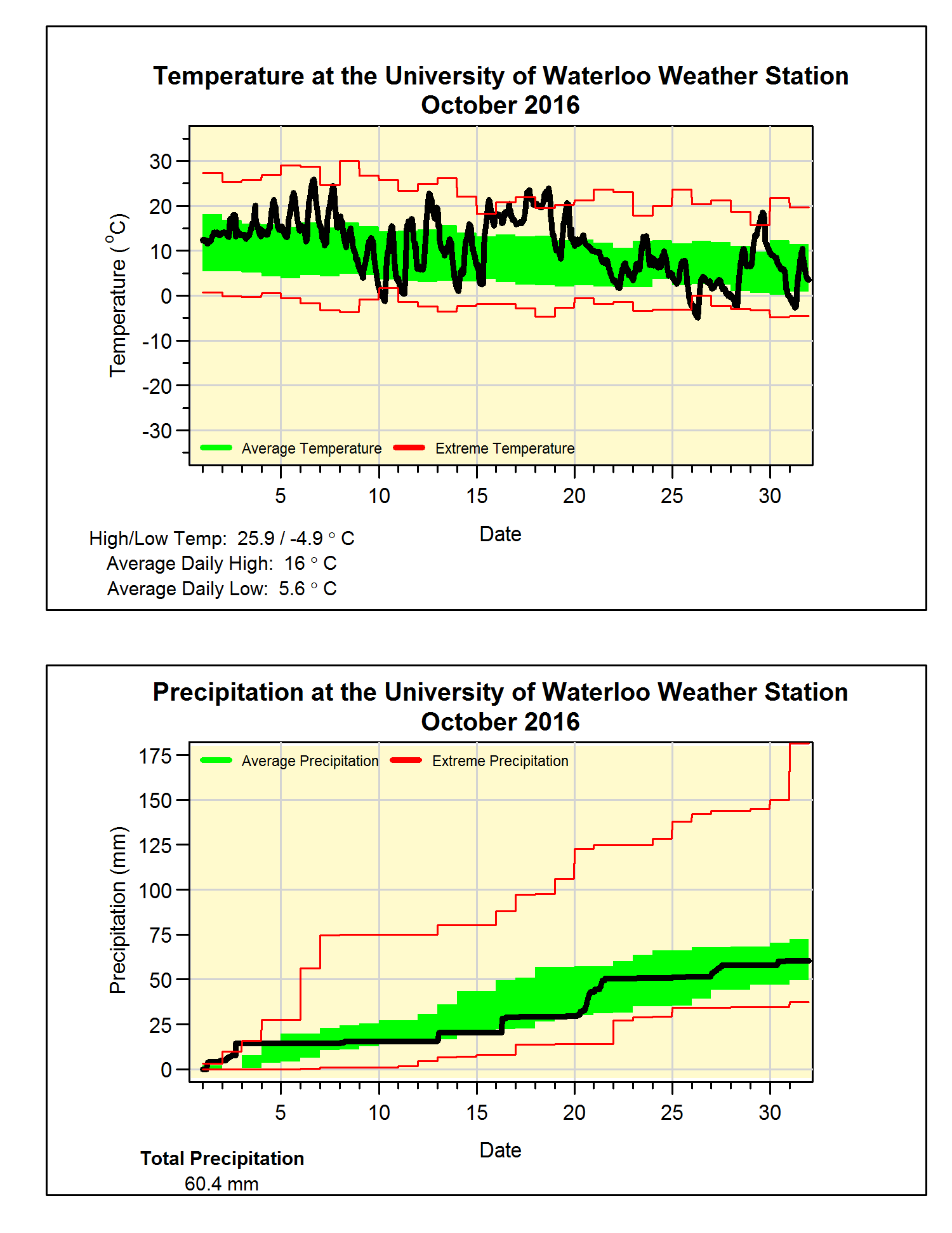
Second warmest October in 45 years with average precipitation
It was another hot month with the average October temperature coming in at 2.6 degrees above average, this made it the second warmest since 1971 (after 2007** See Note below). However, it is also interesting that the on the 26th the temperature got down to -4.9°C which was the coldest October temperature in the region since Oct 14, 1993.
The temperature went below zero on October 10th, this was the first time this had happened since April 30. That means we had 163 days of above zero temperatures, which is pretty much the average length we have seen in the past 15 years (by the way I’m trying to avoid calling it the growing season or frost-free days as those terms seem to cause a lot of confusion).
Although the total precipitation for the month of 60.4 mm was below the average of 67.4 mm, it was close enough to be within the average range. The total for the year so far of 729.4 mm is still a bit below the average for this time of year of 750.6 mm.
Summary for October 2016:
Maximum Temperature 25.9°C
Minimum Temperature -4.9°C
Average Daily High Temperature 16.0°C (Long term average 13.5°C)
Average Daily Low Temperature 5.6°C (Long term average 2.9°C)
Total Precipitation 60.4 mm (Long term average 67.4 mm)
**Note: The first version of this summary mistakenly stated that October 2016 was the warmest in 45 years when in fact it was the second warmest.
(Long term averages based on 1981-2010 data for the Waterloo Wellington Airport)


No comments:
Post a Comment