A cool and dry March
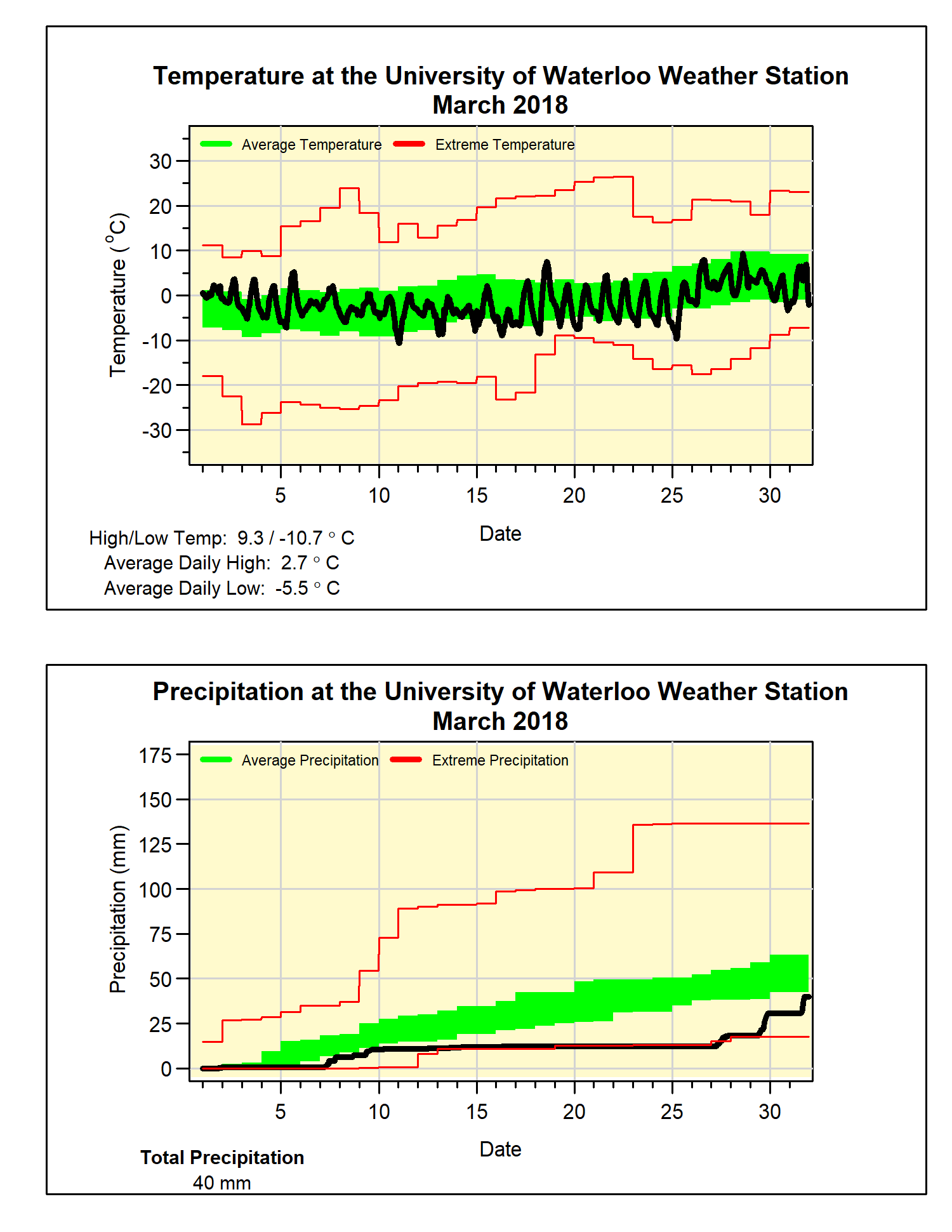
The temperature during March was pretty steady throughout the month, however as the temperature typically goes up by about 6 degrees from the beginning to the end, that means the overall temperature ended up about 0.4 degrees below average. Although it is less than average it is still within the average range.
One interesting thing was we didn’t see any extreme temperatures, the highest temperature of 9.3°C was the lowest since 2001 and the lowest temperature of -10.7°C was the highest since 2000. This 20 degree range compares to an average range of 35.8 degrees and is the 4th lowest range in the 100+ years of weather data in the region.
With a streak of 10 days with no precipitation (and a week before that with very little) it isn’t surprising that it was a below average month for precipitation with only 40.0 mm compared to the average of 61.0 mm.
There was only 9.5 cm of snow which is only about a third of the average for March of 26.5 cm. That brings the total snowfall to 100.5 cm, much less than the average of around 150 cm for the end of this month.
Summary for March 2018:
Maximum Temperature 9.3°C
Minimum Temperature -10.7°C
Average Daily High Temperature 2.7°C (Long term average 3.6°C)
Average Daily Low Temperature -5.5°C (Long term average -5.6°C)
Total Precipitation 40.0 mm (Long term average 61.0 mm)
(Long term averages based on 1981-2010 data for the Waterloo-Wellington Airport)


1 comment:
Check out these temperatures anomolies for North America.
http://models.weatherbell.com/climate/ncep_cfsr_noram_t2m_anom.png
Post a Comment