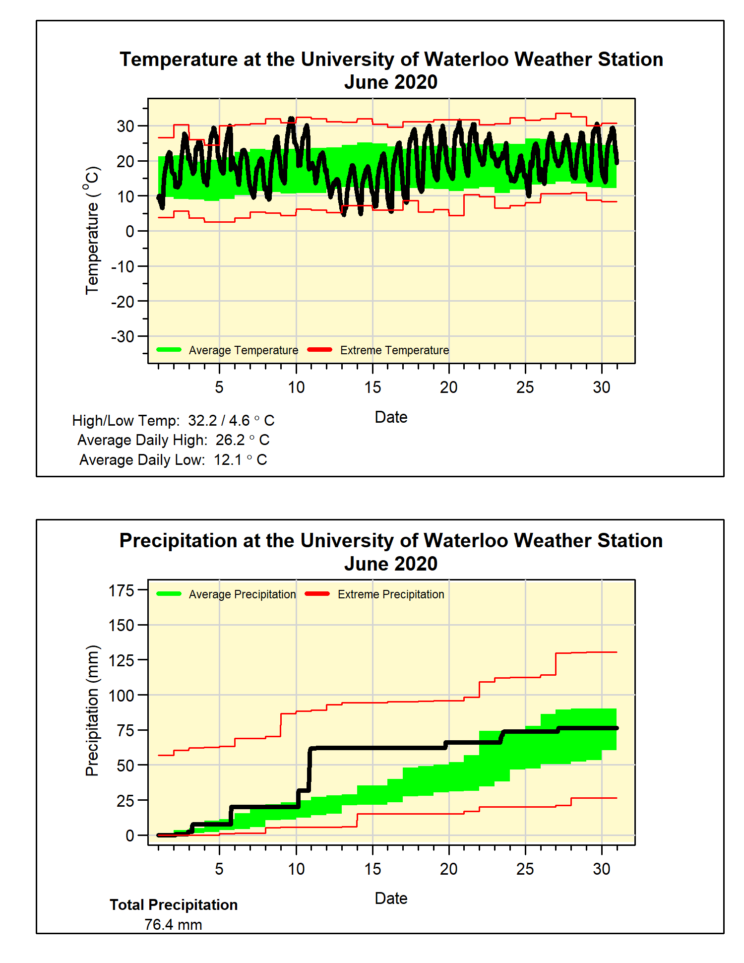
A hot June with average precipitation
There were lots of really hot days in June, including 8 days above 30°C, while we typically average only 2 of those days. With only one cool spell that lasted just 3 days, the average overall temperature was 1.6 degrees above average. This made it the hottest June since 2005.
Although the total precipitation of 76.4 mm was only a little below the average of 82.4 mm, this masks the fact that it was really a very dry month. This discrepancy is a result of over half the month’s precipitation coming in one day (41.8 mm on June 10th), but only about 15 mm came down the rest of the month.
For the first half of the year, the total precipitation we have seen of 503.1 mm is well above the average total of 416.1 mm at the halfway mark. Most of this above average total is still a result of the very wet January.
Summary for June 2020:
Maximum Temperature 32.2°C
Minimum Temperature 4.6°C
Average Daily High Temperature 26.2°C (Long term average 23.6°C)
Average Daily Low Temperature 12.2°C (Long term average 11.5°C)
Total Precipitation 76.4 mm (Long term average 82.4 mm)


1 comment:
Hi there!
I've just come across the Weather Station site and am impressed by all the data that is recorded. I'm specifically curious if the incoming radiation values that show up on the current readings are tracked/archived and whether they can be looked up somewhere?
Post a Comment