A really warm and really dry January
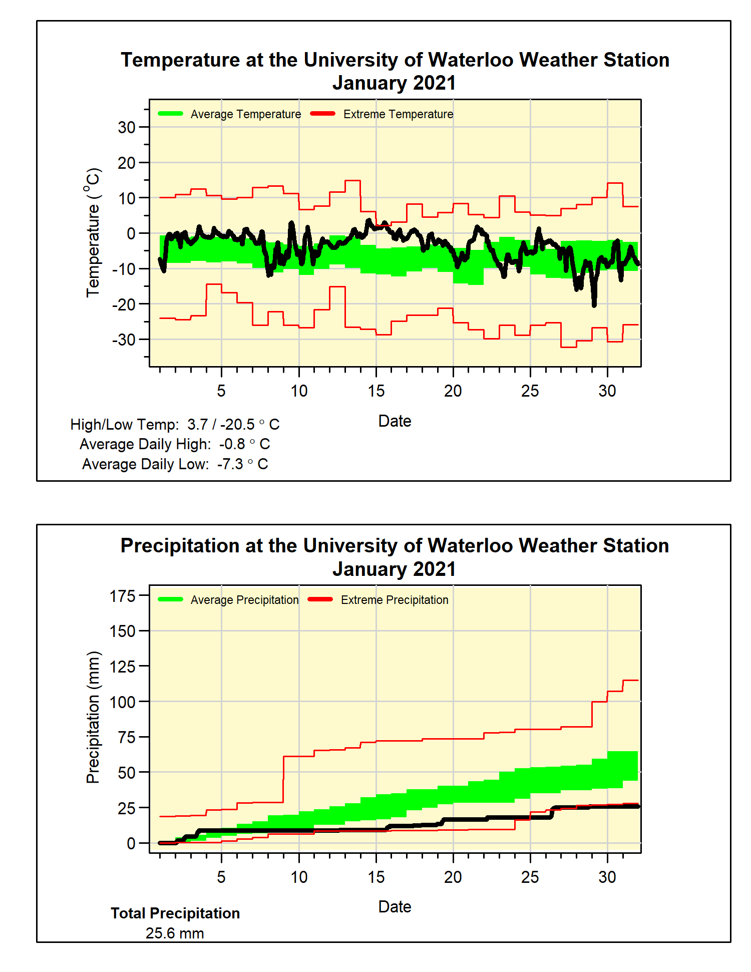
Although the overall temperature was almost two and half degrees warmer than average, most of the days were just a little above average, and there were no dramatically above average days. For instance, the warmest temperature for the month of 3.7°C whereas there is usually about a 50% chance we would see a double digit temperature during the month.
One result of this lack of really warm temperatures was that there wasn’t a major snowmelt during the month, thus most of the snow that fell around Christmas is still on the ground.
In a dramatic turnaround from last year, which was the wettest January in the over 100 years of data in the region, this January was the fifth driest. We only saw 25.6 mm of precipitation this year, the record lowest was back in 1961 when we only had 16.0 mm.
Not surprisingly, the total snowfall of 22.5 cm was only about half of the average of 43.7 cm for the month. But with the amount of snowfall we saw late last year, the total for the snowfall season so far is 89.5 cm, not that far below the 95.3 cm we see on average for this point in the snowfall season.
Summary for January 2021:
Maximum Temperature 3.7°C
Minimum Temperature -20.5°C
Average Daily High Temperature -0.8°C (Long term average -2.6°C)
Average Daily Low Temperature -7.3°C (Long term average -10.3°C)
Total Precipitation 25.6 mm (Long term average 65.2 mm)
(Long term averages based on 1981-2010 data for the Waterloo-Wellington Airport)


No comments:
Post a Comment